You are here: Home > Network List > US - United States National Seismic Network Stations List
> Station VBMS Vicksburg, Mississippi > Earthquake Result Viewer
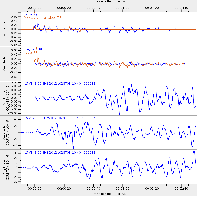
VBMS Vicksburg, Mississippi - Earthquake Result Viewer
*The percent match for this event was below the threshold and hence no stack was calculated.
| Earthquake location: |
Queen Charlotte Islands Region |
| Earthquake latitude/longitude: |
52.8/-132.1 |
| Earthquake time(UTC): |
2012/10/28 (302) 03:04:08 GMT |
| Earthquake Depth: |
14 km |
| Earthquake Magnitude: |
6.5 MB, 7.5 MS, 7.8 MW, 7.8 MW |
| Earthquake Catalog/Contributor: |
WHDF/NEIC |
|
| Network: |
US United States National Seismic Network |
| Station: |
VBMS Vicksburg, Mississippi |
| Lat/Lon: |
32.22 N/90.52 W |
| Elevation: |
0.0 m |
|
| Distance: |
36.2 deg |
| Az: |
107.876 deg |
| Baz: |
317.006 deg |
| Ray Param: |
$rayparam |
*The percent match for this event was below the threshold and hence was not used in the summary stack. |
|
| Radial Match: |
91.30886 % |
| Radial Bump: |
378 |
| Transverse Match: |
66.7134 % |
| Transverse Bump: |
400 |
| SOD ConfigId: |
558545 |
| Insert Time: |
2013-09-17 21:51:59.888 +0000 |
| GWidth: |
2.5 |
| Max Bumps: |
400 |
| Tol: |
0.001 |
|
Signal To Noise
| Channel | StoN | STA | LTA |
| US:VBMS:00:BHZ:20121028T03:10:40.499993Z | 8.316638 | 4.5219026E-6 | 5.437176E-7 |
| US:VBMS:00:BH1:20121028T03:10:40.499993Z | 2.1293676 | 3.3797019E-6 | 1.5871858E-6 |
| US:VBMS:00:BH2:20121028T03:10:40.499993Z | 1.1897529 | 2.2665906E-6 | 1.9050935E-6 |
| Arrivals |
| Ps | |
| PpPs | |
| PsPs/PpSs | |


