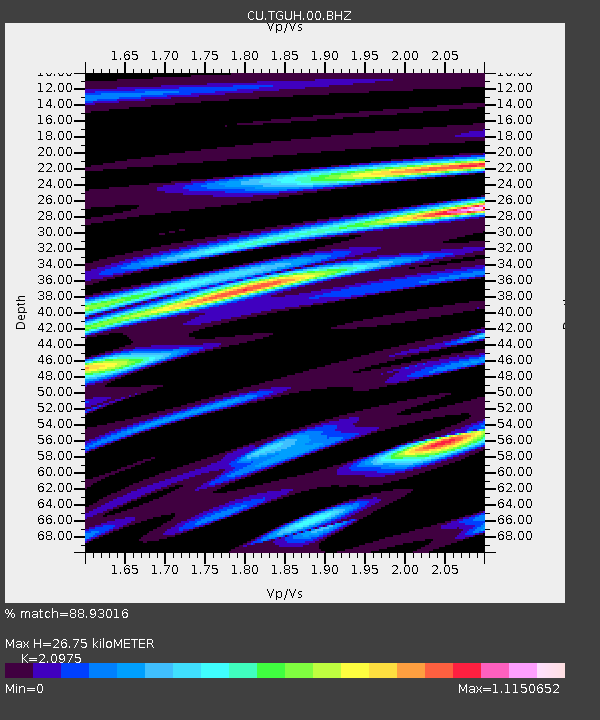
TGUH Tegucigalpa, Honduras - Earthquake Result Viewer

Earthquake location: Queen Charlotte Islands Region
Earthquake latitude/longitude: 52.7/-132.6
Earthquake time(UTC): 2012/10/28 (302) 18:54:20 GMT
Earthquake Depth: 9.0 km
Earthquake Magnitude: 5.9 MB, 6.2 MS, 6.3 MW, 6.3 MW
Earthquake Catalog/Contributor: WHDF/NEIC
Network: CU Caribbean Network (USGS)
Station: TGUH Tegucigalpa, Honduras
Lat/Lon: 14.06 N/87.27 W
Elevation: 0.0 m
Distance: 52.6 deg
Az: 119.736 deg
Baz: 326.986 deg
Ray Param: 0.066635795
Estimated Moho Depth: 26.75 km
Estimated Crust Vp/Vs: 2.10
Assumed Crust Vp: 6.597 km/s
Estimated Crust Vs: 3.145 km/s
Estimated Crust Poisson's Ratio: 0.35
Radial Match: 88.93016 %
Radial Bump: 400
Transverse Match: 79.848724 %
Transverse Bump: 400
SOD ConfigId: 558545
Insert Time: 2013-09-17 21:52:27.601 +0000
GWidth: 2.5
Max Bumps: 400
Tol: 0.001

Signal To Noise

ChannelStoNSTALTA
CU:TGUH:00:BHZ:20121028T19:03:04.10002Z7.7309937.2516997E-79.380036E-8
CU:TGUH:00:BH1:20121028T19:03:04.10002Z1.90360473.0719784E-71.6137689E-7
CU:TGUH:00:BH2:20121028T19:03:04.10002Z1.74773652.574543E-71.4730728E-7
Arrivals
Ps4.7 SECOND
PpPs12 SECOND
PsPs/PpSs17 SECOND