You are here: Home > Network List > IU - Global Seismograph Network (GSN - IRIS/USGS) Stations List
> Station MAJO Matsushiro, Japan > Earthquake Result Viewer
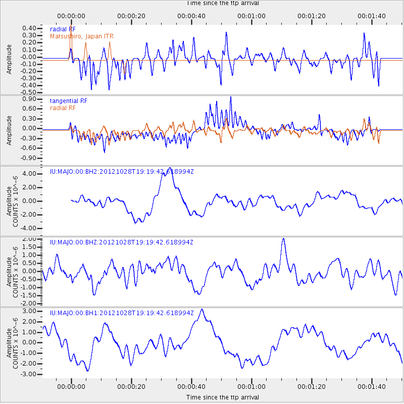
MAJO Matsushiro, Japan - Earthquake Result Viewer
*The percent match for this event was below the threshold and hence no stack was calculated.
| Earthquake location: |
Queen Charlotte Islands Region |
| Earthquake latitude/longitude: |
52.3/-132.1 |
| Earthquake time(UTC): |
2012/10/28 (302) 19:09:53 GMT |
| Earthquake Depth: |
10 km |
| Earthquake Magnitude: |
5.6 MB, 5.8 MW, 5.5 MW |
| Earthquake Catalog/Contributor: |
WHDF/NEIC |
|
| Network: |
IU Global Seismograph Network (GSN - IRIS/USGS) |
| Station: |
MAJO Matsushiro, Japan |
| Lat/Lon: |
36.55 N/138.20 E |
| Elevation: |
405 m |
|
| Distance: |
61.9 deg |
| Az: |
294.144 deg |
| Baz: |
44.104 deg |
| Ray Param: |
$rayparam |
*The percent match for this event was below the threshold and hence was not used in the summary stack. |
|
| Radial Match: |
52.244976 % |
| Radial Bump: |
400 |
| Transverse Match: |
45.729366 % |
| Transverse Bump: |
400 |
| SOD ConfigId: |
558545 |
| Insert Time: |
2013-09-17 21:56:09.144 +0000 |
| GWidth: |
2.5 |
| Max Bumps: |
400 |
| Tol: |
0.001 |
|
Signal To Noise
| Channel | StoN | STA | LTA |
| IU:MAJO:00:BHZ:20121028T19:19:42.618994Z | 0.918651 | 3.2426857E-7 | 3.5298342E-7 |
| IU:MAJO:00:BH1:20121028T19:19:42.618994Z | 2.626221 | 2.002395E-6 | 7.6246243E-7 |
| IU:MAJO:00:BH2:20121028T19:19:42.618994Z | 3.7598112 | 4.2778165E-6 | 1.1377742E-6 |
| Arrivals |
| Ps | |
| PpPs | |
| PsPs/PpSs | |


