You are here: Home > Network List > US - United States National Seismic Network Stations List
> Station LONY Lake Ozonia, New York, USA > Earthquake Result Viewer
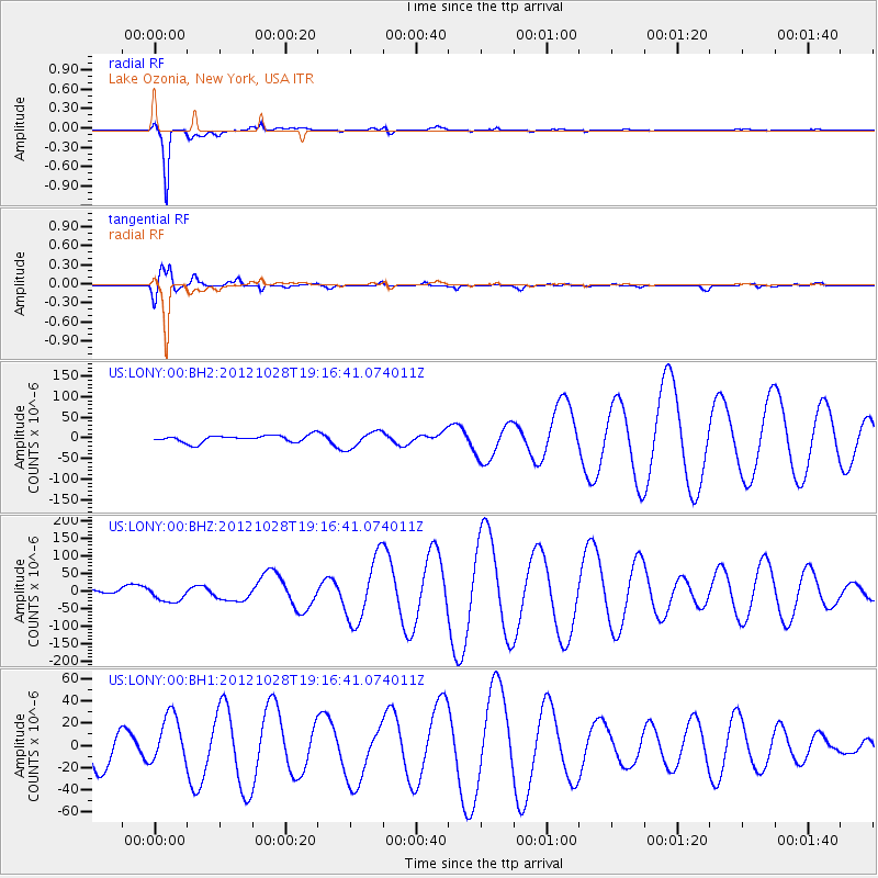
LONY Lake Ozonia, New York, USA - Earthquake Result Viewer
*The percent match for this event was below the threshold and hence no stack was calculated.
| Earthquake location: |
Queen Charlotte Islands Region |
| Earthquake latitude/longitude: |
52.3/-132.1 |
| Earthquake time(UTC): |
2012/10/28 (302) 19:09:53 GMT |
| Earthquake Depth: |
10 km |
| Earthquake Magnitude: |
5.6 MB, 5.8 MW, 5.5 MW |
| Earthquake Catalog/Contributor: |
WHDF/NEIC |
|
| Network: |
US United States National Seismic Network |
| Station: |
LONY Lake Ozonia, New York, USA |
| Lat/Lon: |
44.62 N/74.58 W |
| Elevation: |
440 m |
|
| Distance: |
38.0 deg |
| Az: |
78.083 deg |
| Baz: |
302.702 deg |
| Ray Param: |
$rayparam |
*The percent match for this event was below the threshold and hence was not used in the summary stack. |
|
| Radial Match: |
98.315254 % |
| Radial Bump: |
239 |
| Transverse Match: |
64.47767 % |
| Transverse Bump: |
400 |
| SOD ConfigId: |
558545 |
| Insert Time: |
2013-09-17 21:57:23.022 +0000 |
| GWidth: |
2.5 |
| Max Bumps: |
400 |
| Tol: |
0.001 |
|
Signal To Noise
| Channel | StoN | STA | LTA |
| US:LONY:00:BHZ:20121028T19:16:41.074011Z | 3.1570802 | 2.1151462E-5 | 6.6996913E-6 |
| US:LONY:00:BH1:20121028T19:16:41.074011Z | 1.380474 | 2.2187825E-5 | 1.6072614E-5 |
| US:LONY:00:BH2:20121028T19:16:41.074011Z | 2.3305457 | 1.9583911E-5 | 8.403144E-6 |
| Arrivals |
| Ps | |
| PpPs | |
| PsPs/PpSs | |


