You are here: Home > Network List > IU - Global Seismograph Network (GSN - IRIS/USGS) Stations List
> Station JOHN Johnston Island, USA > Earthquake Result Viewer
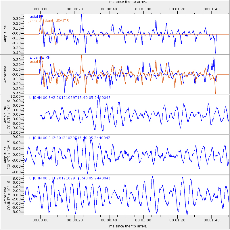
JOHN Johnston Island, USA - Earthquake Result Viewer
*The percent match for this event was below the threshold and hence no stack was calculated.
| Earthquake location: |
Southern Molucca Sea |
| Earthquake latitude/longitude: |
-0.1/125.2 |
| Earthquake time(UTC): |
2012/10/29 (303) 15:29:50 GMT |
| Earthquake Depth: |
35 km |
| Earthquake Magnitude: |
5.6 MB, 5.1 MS, 5.7 MW, 5.5 MW |
| Earthquake Catalog/Contributor: |
WHDF/NEIC |
|
| Network: |
IU Global Seismograph Network (GSN - IRIS/USGS) |
| Station: |
JOHN Johnston Island, USA |
| Lat/Lon: |
16.73 N/169.53 W |
| Elevation: |
2.0 m |
|
| Distance: |
66.4 deg |
| Az: |
71.744 deg |
| Baz: |
262.351 deg |
| Ray Param: |
$rayparam |
*The percent match for this event was below the threshold and hence was not used in the summary stack. |
|
| Radial Match: |
48.886612 % |
| Radial Bump: |
338 |
| Transverse Match: |
48.038727 % |
| Transverse Bump: |
328 |
| SOD ConfigId: |
558545 |
| Insert Time: |
2013-09-17 22:00:07.036 +0000 |
| GWidth: |
2.5 |
| Max Bumps: |
400 |
| Tol: |
0.001 |
|
Signal To Noise
| Channel | StoN | STA | LTA |
| IU:JOHN:00:BHZ:20121029T15:40:05.244004Z | 1.0074744 | 2.6255377E-6 | 2.6060588E-6 |
| IU:JOHN:00:BH1:20121029T15:40:05.244004Z | 1.615022 | 4.139725E-6 | 2.5632626E-6 |
| IU:JOHN:00:BH2:20121029T15:40:05.244004Z | 2.9431474 | 7.3161223E-6 | 2.4858157E-6 |
| Arrivals |
| Ps | |
| PpPs | |
| PsPs/PpSs | |


