AAK Ala Archa, Kyrgyzstan - Earthquake Result Viewer
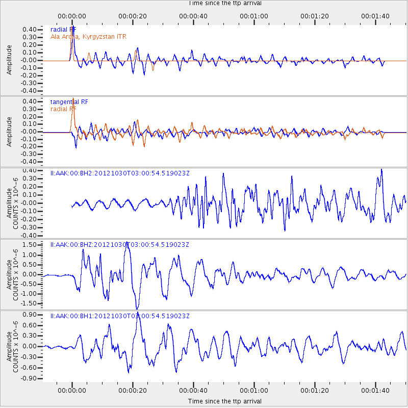
Earthquake location: Queen Charlotte Islands Region
Earthquake latitude/longitude: 52.4/-131.9
Earthquake time(UTC): 2012/10/30 (304) 02:49:02 GMT
Earthquake Depth: 9.0 km
Earthquake Magnitude: 5.8 MB, 6.0 MS, 6.2 MW, 6.2 MW
Earthquake Catalog/Contributor: WHDF/NEIC
Network: II Global Seismograph Network (GSN - IRIS/IDA)
Station: AAK Ala Archa, Kyrgyzstan
Lat/Lon: 42.64 N/74.49 E
Elevation: 1645 m
Distance: 82.7 deg
Az: 340.685 deg
Baz: 15.954 deg
Ray Param: 0.04673767
Estimated Moho Depth: 45.75 km
Estimated Crust Vp/Vs: 2.06
Assumed Crust Vp: 6.306 km/s
Estimated Crust Vs: 3.069 km/s
Estimated Crust Poisson's Ratio: 0.34
Radial Match: 95.40228 %
Radial Bump: 400
Transverse Match: 88.96737 %
Transverse Bump: 400
SOD ConfigId: 558545
Insert Time: 2013-09-17 22:01:08.401 +0000
GWidth: 2.5
Max Bumps: 400
Tol: 0.001

Signal To Noise

ChannelStoNSTALTA
II:AAK:00:BHZ:20121030T03:00:54.519023Z13.5785465.706865E-74.2028546E-8
II:AAK:00:BH1:20121030T03:00:54.519023Z8.3599262.261469E-72.7051303E-8
II:AAK:00:BH2:20121030T03:00:54.519023Z1.21519154.652226E-83.828389E-8
Arrivals
Ps7.8 SECOND
PpPs22 SECOND
PsPs/PpSs30 SECOND