You are here: Home > Network List > US - United States National Seismic Network Stations List
> Station KVTX Kingsville, Texas, USA > Earthquake Result Viewer
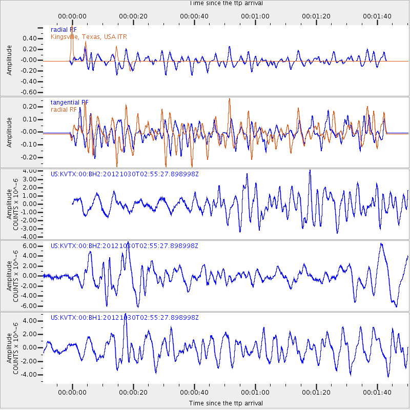
KVTX Kingsville, Texas, USA - Earthquake Result Viewer
*The percent match for this event was below the threshold and hence no stack was calculated.
| Earthquake location: |
Queen Charlotte Islands Region |
| Earthquake latitude/longitude: |
52.4/-131.9 |
| Earthquake time(UTC): |
2012/10/30 (304) 02:49:02 GMT |
| Earthquake Depth: |
9.0 km |
| Earthquake Magnitude: |
5.8 MB, 6.0 MS, 6.2 MW, 6.2 MW |
| Earthquake Catalog/Contributor: |
WHDF/NEIC |
|
| Network: |
US United States National Seismic Network |
| Station: |
KVTX Kingsville, Texas, USA |
| Lat/Lon: |
27.55 N/97.89 W |
| Elevation: |
15 m |
|
| Distance: |
35.4 deg |
| Az: |
121.078 deg |
| Baz: |
323.738 deg |
| Ray Param: |
$rayparam |
*The percent match for this event was below the threshold and hence was not used in the summary stack. |
|
| Radial Match: |
55.926197 % |
| Radial Bump: |
400 |
| Transverse Match: |
67.0767 % |
| Transverse Bump: |
400 |
| SOD ConfigId: |
558545 |
| Insert Time: |
2013-09-17 22:04:03.136 +0000 |
| GWidth: |
2.5 |
| Max Bumps: |
400 |
| Tol: |
0.001 |
|
Signal To Noise
| Channel | StoN | STA | LTA |
| US:KVTX:00:BHZ:20121030T02:55:27.898998Z | 3.1424494 | 9.985197E-7 | 3.1775204E-7 |
| US:KVTX:00:BH1:20121030T02:55:27.898998Z | 1.5081238 | 8.6552063E-7 | 5.739056E-7 |
| US:KVTX:00:BH2:20121030T02:55:27.898998Z | 0.81655645 | 5.917081E-7 | 7.246383E-7 |
| Arrivals |
| Ps | |
| PpPs | |
| PsPs/PpSs | |


