You are here: Home > Network List > IU - Global Seismograph Network (GSN - IRIS/USGS) Stations List
> Station CTAO Charters Towers, Australia > Earthquake Result Viewer
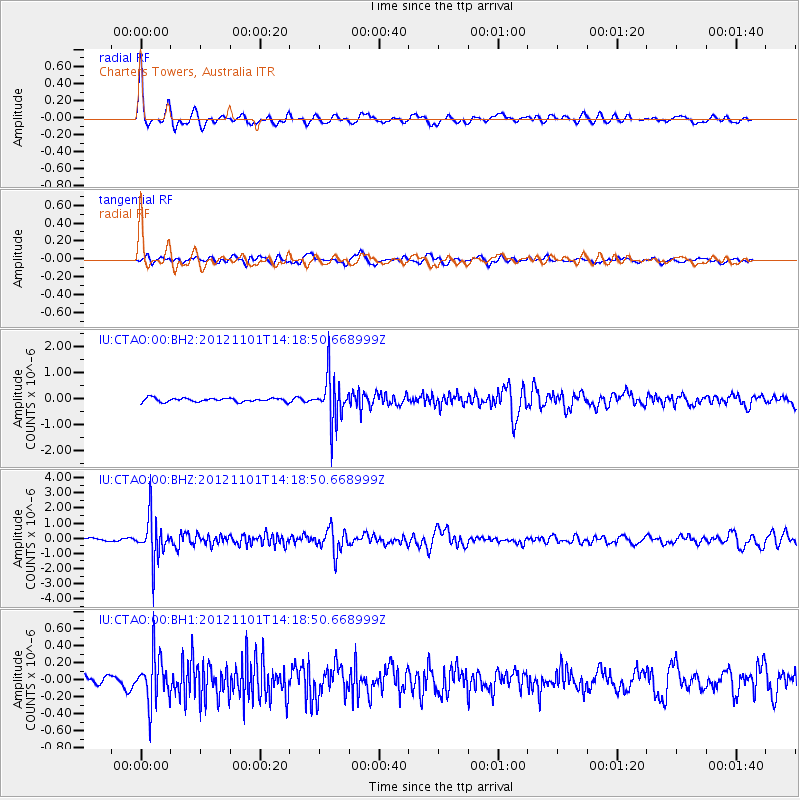
CTAO Charters Towers, Australia - Earthquake Result Viewer
*The percent match for this event was below the threshold and hence no stack was calculated.
| Earthquake location: |
Java, Indonesia |
| Earthquake latitude/longitude: |
-6.8/107.5 |
| Earthquake time(UTC): |
2012/11/01 (306) 14:12:01 GMT |
| Earthquake Depth: |
142 km |
| Earthquake Magnitude: |
5.8 MB, 5.7 MW, 5.7 MW |
| Earthquake Catalog/Contributor: |
WHDF/NEIC |
|
| Network: |
IU Global Seismograph Network (GSN - IRIS/USGS) |
| Station: |
CTAO Charters Towers, Australia |
| Lat/Lon: |
20.09 S/146.25 E |
| Elevation: |
357 m |
|
| Distance: |
39.8 deg |
| Az: |
113.308 deg |
| Baz: |
283.974 deg |
| Ray Param: |
$rayparam |
*The percent match for this event was below the threshold and hence was not used in the summary stack. |
|
| Radial Match: |
73.198044 % |
| Radial Bump: |
393 |
| Transverse Match: |
60.019268 % |
| Transverse Bump: |
400 |
| SOD ConfigId: |
558545 |
| Insert Time: |
2013-09-17 22:05:19.664 +0000 |
| GWidth: |
2.5 |
| Max Bumps: |
400 |
| Tol: |
0.001 |
|
Signal To Noise
| Channel | StoN | STA | LTA |
| IU:CTAO:00:BHZ:20121101T14:18:50.668999Z | 14.35521 | 1.4469771E-6 | 1.0079804E-7 |
| IU:CTAO:00:BH1:20121101T14:18:50.668999Z | 2.9411633 | 2.8185687E-7 | 9.5831766E-8 |
| IU:CTAO:00:BH2:20121101T14:18:50.668999Z | 12.490392 | 8.9753803E-7 | 7.185828E-8 |
| Arrivals |
| Ps | |
| PpPs | |
| PsPs/PpSs | |


