You are here: Home > Network List > IU - Global Seismograph Network (GSN - IRIS/USGS) Stations List
> Station HNR Honiara, Solomon Islands > Earthquake Result Viewer
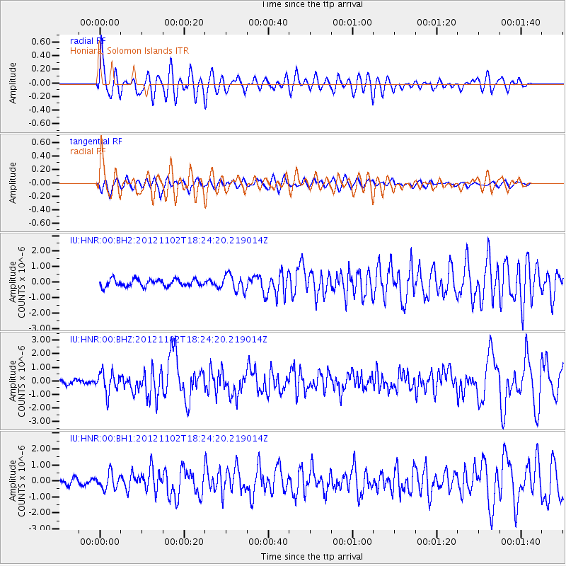
HNR Honiara, Solomon Islands - Earthquake Result Viewer
*The percent match for this event was below the threshold and hence no stack was calculated.
| Earthquake location: |
Mindanao, Philippines |
| Earthquake latitude/longitude: |
9.2/126.2 |
| Earthquake time(UTC): |
2012/11/02 (307) 18:17:32 GMT |
| Earthquake Depth: |
37 km |
| Earthquake Magnitude: |
6.2 MB, 5.7 MS, 6.1 MW, 6.1 MW |
| Earthquake Catalog/Contributor: |
WHDF/NEIC |
|
| Network: |
IU Global Seismograph Network (GSN - IRIS/USGS) |
| Station: |
HNR Honiara, Solomon Islands |
| Lat/Lon: |
9.44 S/159.95 E |
| Elevation: |
100 m |
|
| Distance: |
38.4 deg |
| Az: |
117.97 deg |
| Baz: |
297.903 deg |
| Ray Param: |
$rayparam |
*The percent match for this event was below the threshold and hence was not used in the summary stack. |
|
| Radial Match: |
70.84078 % |
| Radial Bump: |
400 |
| Transverse Match: |
66.037254 % |
| Transverse Bump: |
400 |
| SOD ConfigId: |
558545 |
| Insert Time: |
2013-09-17 22:15:46.571 +0000 |
| GWidth: |
2.5 |
| Max Bumps: |
400 |
| Tol: |
0.001 |
|
Signal To Noise
| Channel | StoN | STA | LTA |
| IU:HNR:00:BHZ:20121102T18:24:20.219014Z | 4.680379 | 7.748414E-7 | 1.65551E-7 |
| IU:HNR:00:BH1:20121102T18:24:20.219014Z | 2.530295 | 5.0072197E-7 | 1.9789074E-7 |
| IU:HNR:00:BH2:20121102T18:24:20.219014Z | 2.345502 | 5.386247E-7 | 2.2964157E-7 |
| Arrivals |
| Ps | |
| PpPs | |
| PsPs/PpSs | |


