You are here: Home > Network List > IU - Global Seismograph Network (GSN - IRIS/USGS) Stations List
> Station CTAO Charters Towers, Australia > Earthquake Result Viewer
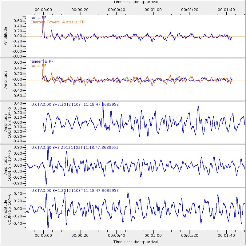
CTAO Charters Towers, Australia - Earthquake Result Viewer
*The percent match for this event was below the threshold and hence no stack was calculated.
| Earthquake location: |
Philippine Islands Region |
| Earthquake latitude/longitude: |
10.5/126.9 |
| Earthquake time(UTC): |
2012/11/03 (308) 11:12:21 GMT |
| Earthquake Depth: |
35 km |
| Earthquake Magnitude: |
5.5 MB, 5.3 MW |
| Earthquake Catalog/Contributor: |
WHDF/NEIC |
|
| Network: |
IU Global Seismograph Network (GSN - IRIS/USGS) |
| Station: |
CTAO Charters Towers, Australia |
| Lat/Lon: |
20.09 S/146.25 E |
| Elevation: |
357 m |
|
| Distance: |
35.9 deg |
| Az: |
147.94 deg |
| Baz: |
326.262 deg |
| Ray Param: |
$rayparam |
*The percent match for this event was below the threshold and hence was not used in the summary stack. |
|
| Radial Match: |
74.046165 % |
| Radial Bump: |
342 |
| Transverse Match: |
58.491344 % |
| Transverse Bump: |
400 |
| SOD ConfigId: |
558545 |
| Insert Time: |
2013-09-17 22:17:58.793 +0000 |
| GWidth: |
2.5 |
| Max Bumps: |
400 |
| Tol: |
0.001 |
|
Signal To Noise
| Channel | StoN | STA | LTA |
| IU:CTAO:00:BHZ:20121103T11:18:47.868995Z | 5.1711006 | 4.4460623E-7 | 8.597903E-8 |
| IU:CTAO:00:BH1:20121103T11:18:47.868995Z | 3.9923446 | 2.1748409E-7 | 5.447528E-8 |
| IU:CTAO:00:BH2:20121103T11:18:47.868995Z | 1.5494859 | 1.4799174E-7 | 9.5510224E-8 |
| Arrivals |
| Ps | |
| PpPs | |
| PsPs/PpSs | |


