You are here: Home > Network List > US - United States National Seismic Network Stations List
> Station MSO Missoula, Montana, USA > Earthquake Result Viewer
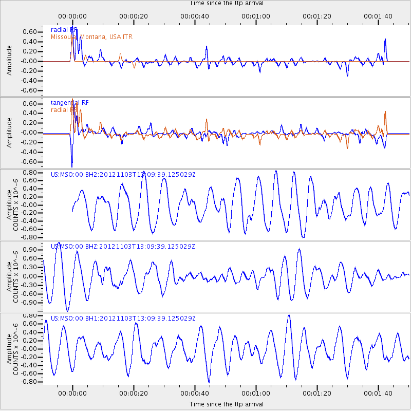
MSO Missoula, Montana, USA - Earthquake Result Viewer
*The percent match for this event was below the threshold and hence no stack was calculated.
| Earthquake location: |
Central Mid-Atlantic Ridge |
| Earthquake latitude/longitude: |
7.0/-34.1 |
| Earthquake time(UTC): |
2012/11/03 (308) 12:58:12 GMT |
| Earthquake Depth: |
10 km |
| Earthquake Magnitude: |
5.5 MB, 5.2 MS, 5.6 MW, 5.6 MW |
| Earthquake Catalog/Contributor: |
WHDF/NEIC |
|
| Network: |
US United States National Seismic Network |
| Station: |
MSO Missoula, Montana, USA |
| Lat/Lon: |
46.83 N/113.94 W |
| Elevation: |
1264 m |
|
| Distance: |
78.0 deg |
| Az: |
316.283 deg |
| Baz: |
92.535 deg |
| Ray Param: |
$rayparam |
*The percent match for this event was below the threshold and hence was not used in the summary stack. |
|
| Radial Match: |
72.20445 % |
| Radial Bump: |
400 |
| Transverse Match: |
69.79006 % |
| Transverse Bump: |
400 |
| SOD ConfigId: |
558545 |
| Insert Time: |
2013-09-17 22:22:05.366 +0000 |
| GWidth: |
2.5 |
| Max Bumps: |
400 |
| Tol: |
0.001 |
|
Signal To Noise
| Channel | StoN | STA | LTA |
| US:MSO:00:BHZ:20121103T13:09:39.125029Z | 1.8219377 | 5.7160565E-7 | 3.1373503E-7 |
| US:MSO:00:BH1:20121103T13:09:39.125029Z | 0.8737116 | 3.0758935E-7 | 3.5204906E-7 |
| US:MSO:00:BH2:20121103T13:09:39.125029Z | 1.1953291 | 4.4470357E-7 | 3.720344E-7 |
| Arrivals |
| Ps | |
| PpPs | |
| PsPs/PpSs | |


