You are here: Home > Network List > UW - Pacific Northwest Regional Seismic Network Stations List
> Station LEBA Lebam, WA, USA > Earthquake Result Viewer
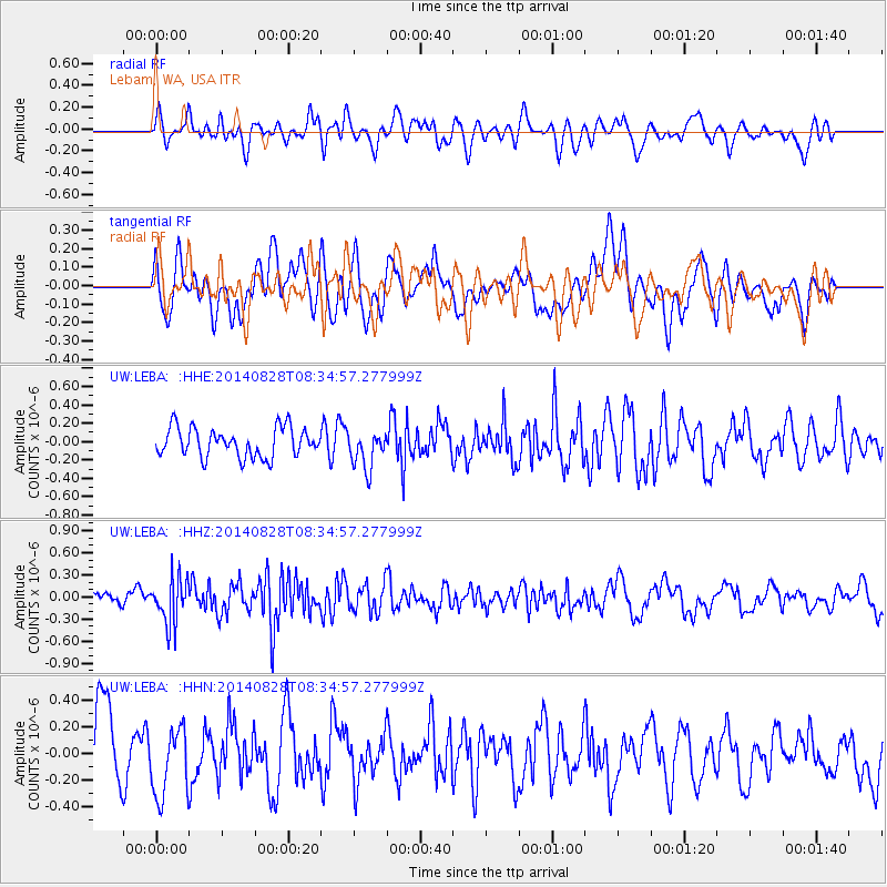
LEBA Lebam, WA, USA - Earthquake Result Viewer
*The percent match for this event was below the threshold and hence no stack was calculated.
| Earthquake location: |
Guatemala |
| Earthquake latitude/longitude: |
14.1/-91.9 |
| Earthquake time(UTC): |
2014/08/28 (240) 08:27:41 GMT |
| Earthquake Depth: |
35 km |
| Earthquake Magnitude: |
5.2 MW, 5.2 mb, 5.0 Md, 5.2 Md |
| Earthquake Catalog/Contributor: |
ISC/ISC |
|
| Network: |
UW Pacific Northwest Regional Seismic Network |
| Station: |
LEBA Lebam, WA, USA |
| Lat/Lon: |
46.55 N/123.56 W |
| Elevation: |
73 m |
|
| Distance: |
41.8 deg |
| Az: |
327.055 deg |
| Baz: |
130.147 deg |
| Ray Param: |
$rayparam |
*The percent match for this event was below the threshold and hence was not used in the summary stack. |
|
| Radial Match: |
52.79107 % |
| Radial Bump: |
400 |
| Transverse Match: |
43.176414 % |
| Transverse Bump: |
400 |
| SOD ConfigId: |
3390531 |
| Insert Time: |
2019-04-13 16:40:28.665 +0000 |
| GWidth: |
2.5 |
| Max Bumps: |
400 |
| Tol: |
0.001 |
|
Signal To Noise
| Channel | StoN | STA | LTA |
| UW:LEBA: :HHZ:20140828T08:34:57.277999Z | 3.413393 | 3.111949E-7 | 9.116878E-8 |
| UW:LEBA: :HHN:20140828T08:34:57.277999Z | 1.20422 | 2.6255213E-7 | 2.1802671E-7 |
| UW:LEBA: :HHE:20140828T08:34:57.277999Z | 1.2978681 | 2.0581754E-7 | 1.5858124E-7 |
| Arrivals |
| Ps | |
| PpPs | |
| PsPs/PpSs | |


