You are here: Home > Network List > UW - Pacific Northwest Regional Seismic Network Stations List
> Station YACT Amboy, WA, USA > Earthquake Result Viewer
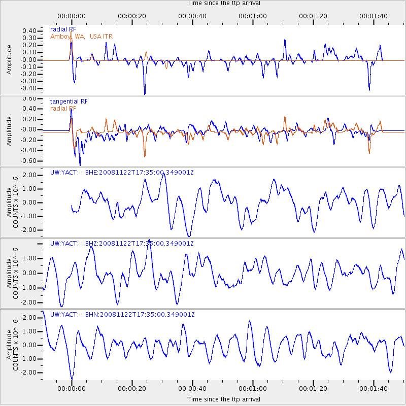
YACT Amboy, WA, USA - Earthquake Result Viewer
*The percent match for this event was below the threshold and hence no stack was calculated.
| Earthquake location: |
Southeast Of Loyalty Islands |
| Earthquake latitude/longitude: |
-22.4/171.2 |
| Earthquake time(UTC): |
2008/11/22 (327) 17:22:36 GMT |
| Earthquake Depth: |
69 km |
| Earthquake Magnitude: |
5.5 MB |
| Earthquake Catalog/Contributor: |
WHDF/NEIC |
|
| Network: |
UW Pacific Northwest Regional Seismic Network |
| Station: |
YACT Amboy, WA, USA |
| Lat/Lon: |
45.93 N/122.42 W |
| Elevation: |
211 m |
|
| Distance: |
90.7 deg |
| Az: |
39.741 deg |
| Baz: |
237.94 deg |
| Ray Param: |
$rayparam |
*The percent match for this event was below the threshold and hence was not used in the summary stack. |
|
| Radial Match: |
53.64813 % |
| Radial Bump: |
392 |
| Transverse Match: |
59.675354 % |
| Transverse Bump: |
400 |
| SOD ConfigId: |
2658 |
| Insert Time: |
2010-02-27 05:23:28.357 +0000 |
| GWidth: |
2.5 |
| Max Bumps: |
400 |
| Tol: |
0.001 |
|
Signal To Noise
| Channel | StoN | STA | LTA |
| UW:YACT: :BHZ:20081122T17:35:00.349001Z | 0.66816586 | 5.710032E-7 | 8.5458305E-7 |
| UW:YACT: :BHN:20081122T17:35:00.349001Z | 1.0446172 | 1.2625349E-6 | 1.2086101E-6 |
| UW:YACT: :BHE:20081122T17:35:00.349001Z | 2.1354167 | 1.4387173E-6 | 6.737408E-7 |
| Arrivals |
| Ps | |
| PpPs | |
| PsPs/PpSs | |


