You are here: Home > Network List > II - Global Seismograph Network (GSN - IRIS/IDA) Stations List
> Station PALK Pallekele, Sri Lanka > Earthquake Result Viewer
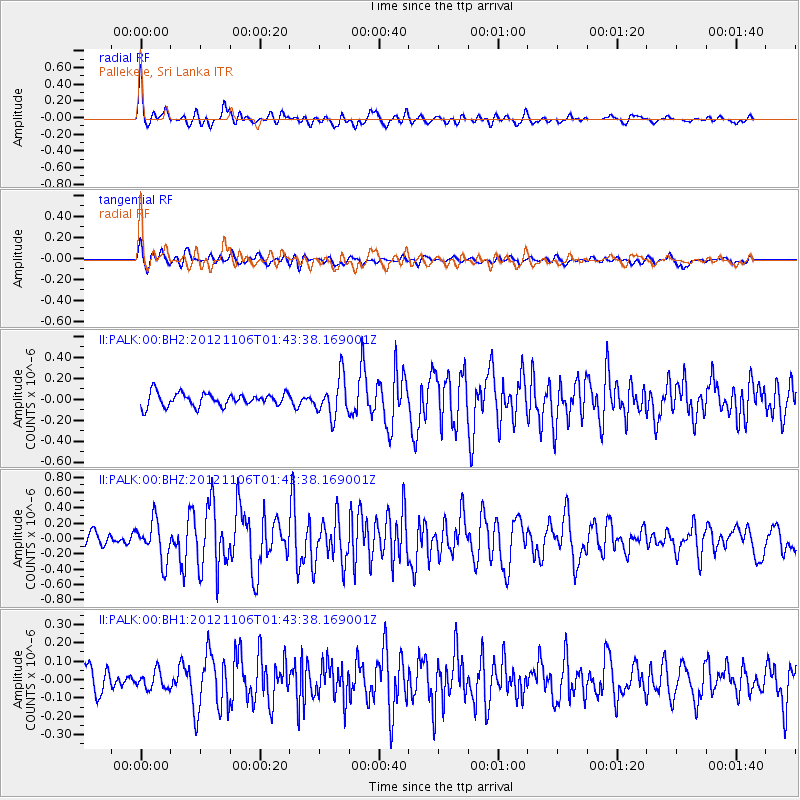
PALK Pallekele, Sri Lanka - Earthquake Result Viewer
*The percent match for this event was below the threshold and hence no stack was calculated.
| Earthquake location: |
Minahassa Peninsula, Sulawesi |
| Earthquake latitude/longitude: |
1.4/122.2 |
| Earthquake time(UTC): |
2012/11/06 (311) 01:36:21 GMT |
| Earthquake Depth: |
25 km |
| Earthquake Magnitude: |
5.7 MB, 5.2 MS, 5.7 MW, 5.6 MW |
| Earthquake Catalog/Contributor: |
WHDF/NEIC |
|
| Network: |
II Global Seismograph Network (GSN - IRIS/IDA) |
| Station: |
PALK Pallekele, Sri Lanka |
| Lat/Lon: |
7.27 N/80.70 E |
| Elevation: |
460 m |
|
| Distance: |
41.8 deg |
| Az: |
279.333 deg |
| Baz: |
96.078 deg |
| Ray Param: |
$rayparam |
*The percent match for this event was below the threshold and hence was not used in the summary stack. |
|
| Radial Match: |
78.96481 % |
| Radial Bump: |
400 |
| Transverse Match: |
64.999855 % |
| Transverse Bump: |
400 |
| SOD ConfigId: |
558545 |
| Insert Time: |
2013-09-17 22:28:27.737 +0000 |
| GWidth: |
2.5 |
| Max Bumps: |
400 |
| Tol: |
0.001 |
|
Signal To Noise
| Channel | StoN | STA | LTA |
| II:PALK:00:BHZ:20121106T01:43:38.169001Z | 3.4036689 | 2.5669644E-7 | 7.541757E-8 |
| II:PALK:00:BH1:20121106T01:43:38.169001Z | 0.8235587 | 4.798905E-8 | 5.827035E-8 |
| II:PALK:00:BH2:20121106T01:43:38.169001Z | 2.9367046 | 1.8345511E-7 | 6.2469724E-8 |
| Arrivals |
| Ps | |
| PpPs | |
| PsPs/PpSs | |


