You are here: Home > Network List > IU - Global Seismograph Network (GSN - IRIS/USGS) Stations List
> Station SNZO South Karori, New Zealand > Earthquake Result Viewer
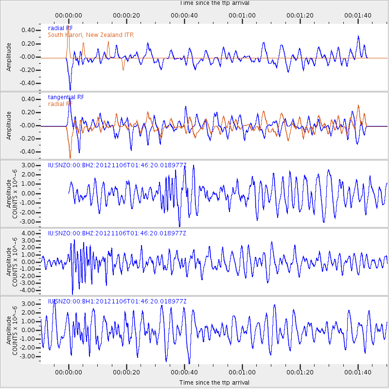
SNZO South Karori, New Zealand - Earthquake Result Viewer
*The percent match for this event was below the threshold and hence no stack was calculated.
| Earthquake location: |
Minahassa Peninsula, Sulawesi |
| Earthquake latitude/longitude: |
1.4/122.2 |
| Earthquake time(UTC): |
2012/11/06 (311) 01:36:21 GMT |
| Earthquake Depth: |
25 km |
| Earthquake Magnitude: |
5.7 MB, 5.2 MS, 5.7 MW, 5.6 MW |
| Earthquake Catalog/Contributor: |
WHDF/NEIC |
|
| Network: |
IU Global Seismograph Network (GSN - IRIS/USGS) |
| Station: |
SNZO South Karori, New Zealand |
| Lat/Lon: |
41.31 S/174.70 E |
| Elevation: |
120 m |
|
| Distance: |
63.7 deg |
| Az: |
138.193 deg |
| Baz: |
297.796 deg |
| Ray Param: |
$rayparam |
*The percent match for this event was below the threshold and hence was not used in the summary stack. |
|
| Radial Match: |
42.47167 % |
| Radial Bump: |
400 |
| Transverse Match: |
47.653824 % |
| Transverse Bump: |
400 |
| SOD ConfigId: |
558545 |
| Insert Time: |
2013-09-17 22:29:49.308 +0000 |
| GWidth: |
2.5 |
| Max Bumps: |
400 |
| Tol: |
0.001 |
|
Signal To Noise
| Channel | StoN | STA | LTA |
| IU:SNZO:00:BHZ:20121106T01:46:20.018977Z | 2.5406666 | 1.8425716E-6 | 7.2523153E-7 |
| IU:SNZO:00:BH1:20121106T01:46:20.018977Z | 1.1449262 | 1.2648062E-6 | 1.1047055E-6 |
| IU:SNZO:00:BH2:20121106T01:46:20.018977Z | 1.2408066 | 1.0081421E-6 | 8.1248936E-7 |
| Arrivals |
| Ps | |
| PpPs | |
| PsPs/PpSs | |


