You are here: Home > Network List > US - United States National Seismic Network Stations List
> Station BRAL Brewton, Alabama, USA > Earthquake Result Viewer
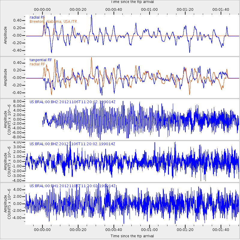
BRAL Brewton, Alabama, USA - Earthquake Result Viewer
*The percent match for this event was below the threshold and hence no stack was calculated.
| Earthquake location: |
Southeast Of Easter Island |
| Earthquake latitude/longitude: |
-35.5/-104.8 |
| Earthquake time(UTC): |
2012/11/06 (311) 11:09:31 GMT |
| Earthquake Depth: |
10 km |
| Earthquake Magnitude: |
5.5 MW, 4.9 MS, 4.7 MB, 5.6 MW |
| Earthquake Catalog/Contributor: |
WHDF/NEIC |
|
| Network: |
US United States National Seismic Network |
| Station: |
BRAL Brewton, Alabama, USA |
| Lat/Lon: |
31.01 N/87.06 W |
| Elevation: |
61 m |
|
| Distance: |
68.2 deg |
| Az: |
16.368 deg |
| Baz: |
195.541 deg |
| Ray Param: |
$rayparam |
*The percent match for this event was below the threshold and hence was not used in the summary stack. |
|
| Radial Match: |
69.48247 % |
| Radial Bump: |
400 |
| Transverse Match: |
47.5895 % |
| Transverse Bump: |
400 |
| SOD ConfigId: |
558545 |
| Insert Time: |
2013-09-17 22:36:14.043 +0000 |
| GWidth: |
2.5 |
| Max Bumps: |
400 |
| Tol: |
0.001 |
|
Signal To Noise
| Channel | StoN | STA | LTA |
| US:BRAL:00:BHZ:20121106T11:20:02.199014Z | 1.3936043 | 1.0609045E-6 | 7.612667E-7 |
| US:BRAL:00:BH1:20121106T11:20:02.199014Z | 1.4184809 | 1.7973936E-6 | 1.2671256E-6 |
| US:BRAL:00:BH2:20121106T11:20:02.199014Z | 2.076373 | 4.905095E-6 | 2.3623377E-6 |
| Arrivals |
| Ps | |
| PpPs | |
| PsPs/PpSs | |


