You are here: Home > Network List > US - United States National Seismic Network Stations List
> Station EGMT Eagleton, Montana, USA > Earthquake Result Viewer
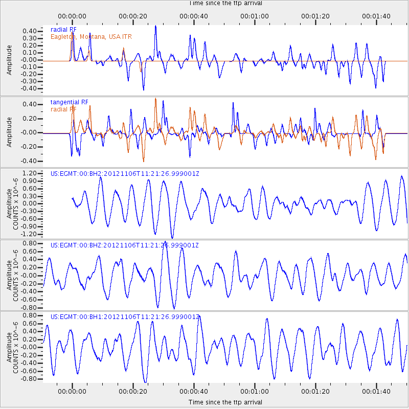
EGMT Eagleton, Montana, USA - Earthquake Result Viewer
*The percent match for this event was below the threshold and hence no stack was calculated.
| Earthquake location: |
Southeast Of Easter Island |
| Earthquake latitude/longitude: |
-35.5/-104.8 |
| Earthquake time(UTC): |
2012/11/06 (311) 11:09:31 GMT |
| Earthquake Depth: |
10 km |
| Earthquake Magnitude: |
5.5 MW, 4.9 MS, 4.7 MB, 5.6 MW |
| Earthquake Catalog/Contributor: |
WHDF/NEIC |
|
| Network: |
US United States National Seismic Network |
| Station: |
EGMT Eagleton, Montana, USA |
| Lat/Lon: |
48.02 N/109.75 W |
| Elevation: |
1055 m |
|
| Distance: |
83.2 deg |
| Az: |
356.653 deg |
| Baz: |
175.929 deg |
| Ray Param: |
$rayparam |
*The percent match for this event was below the threshold and hence was not used in the summary stack. |
|
| Radial Match: |
66.22433 % |
| Radial Bump: |
400 |
| Transverse Match: |
48.00695 % |
| Transverse Bump: |
317 |
| SOD ConfigId: |
558545 |
| Insert Time: |
2013-09-17 22:36:31.158 +0000 |
| GWidth: |
2.5 |
| Max Bumps: |
400 |
| Tol: |
0.001 |
|
Signal To Noise
| Channel | StoN | STA | LTA |
| US:EGMT:00:BHZ:20121106T11:21:26.999001Z | 1.0974997 | 2.2166378E-7 | 2.0197162E-7 |
| US:EGMT:00:BH1:20121106T11:21:26.999001Z | 1.1186378 | 3.7171503E-7 | 3.322926E-7 |
| US:EGMT:00:BH2:20121106T11:21:26.999001Z | 1.4990065 | 7.5092316E-7 | 5.0094724E-7 |
| Arrivals |
| Ps | |
| PpPs | |
| PsPs/PpSs | |


