You are here: Home > Network List > GS - US Geological Survey Networks Stations List
> Station KAN10 Keim Farm > Earthquake Result Viewer
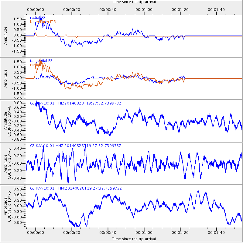
KAN10 Keim Farm - Earthquake Result Viewer
*The percent match for this event was below the threshold and hence no stack was calculated.
| Earthquake location: |
Shikoku, Japan |
| Earthquake latitude/longitude: |
32.1/132.1 |
| Earthquake time(UTC): |
2014/08/28 (240) 19:14:35 GMT |
| Earthquake Depth: |
22 km |
| Earthquake Magnitude: |
5.8 MWB |
| Earthquake Catalog/Contributor: |
NEIC PDE/NEIC COMCAT |
|
| Network: |
GS US Geological Survey Networks |
| Station: |
KAN10 Keim Farm |
| Lat/Lon: |
37.12 N/98.10 W |
| Elevation: |
417 m |
|
| Distance: |
96.7 deg |
| Az: |
38.189 deg |
| Baz: |
318.962 deg |
| Ray Param: |
$rayparam |
*The percent match for this event was below the threshold and hence was not used in the summary stack. |
|
| Radial Match: |
43.365456 % |
| Radial Bump: |
400 |
| Transverse Match: |
55.125244 % |
| Transverse Bump: |
400 |
| SOD ConfigId: |
3390531 |
| Insert Time: |
2019-04-13 16:43:43.133 +0000 |
| GWidth: |
2.5 |
| Max Bumps: |
400 |
| Tol: |
0.001 |
|
Signal To Noise
| Channel | StoN | STA | LTA |
| GS:KAN10:01:HHZ:20140828T19:27:32.739973Z | 1.1585032 | 1.8792504E-7 | 1.6221367E-7 |
| GS:KAN10:01:HHN:20140828T19:27:32.739973Z | 1.535875 | 5.0332187E-7 | 3.2771018E-7 |
| GS:KAN10:01:HHE:20140828T19:27:32.739973Z | 0.92812186 | 3.1481463E-7 | 3.3919537E-7 |
| Arrivals |
| Ps | |
| PpPs | |
| PsPs/PpSs | |


