You are here: Home > Network List > CU - Caribbean Network (USGS) Stations List
> Station BBGH Gun Hill, Barbados > Earthquake Result Viewer
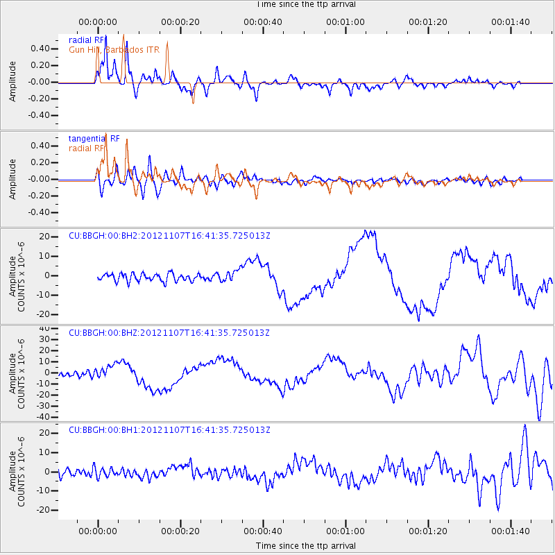
BBGH Gun Hill, Barbados - Earthquake Result Viewer
*The percent match for this event was below the threshold and hence no stack was calculated.
| Earthquake location: |
Near Coast Of Guatemala |
| Earthquake latitude/longitude: |
14.0/-91.9 |
| Earthquake time(UTC): |
2012/11/07 (312) 16:35:46 GMT |
| Earthquake Depth: |
24 km |
| Earthquake Magnitude: |
7.3 MW, 6.6 MB, 7.4 MS, 7.4 MW |
| Earthquake Catalog/Contributor: |
NEIC PDE/NEIC PDE-W |
|
| Network: |
CU Caribbean Network (USGS) |
| Station: |
BBGH Gun Hill, Barbados |
| Lat/Lon: |
13.14 N/59.56 W |
| Elevation: |
180 m |
|
| Distance: |
31.4 deg |
| Az: |
87.623 deg |
| Baz: |
275.354 deg |
| Ray Param: |
$rayparam |
*The percent match for this event was below the threshold and hence was not used in the summary stack. |
|
| Radial Match: |
90.406876 % |
| Radial Bump: |
400 |
| Transverse Match: |
68.21092 % |
| Transverse Bump: |
400 |
| SOD ConfigId: |
558545 |
| Insert Time: |
2013-09-17 22:44:13.028 +0000 |
| GWidth: |
2.5 |
| Max Bumps: |
400 |
| Tol: |
0.001 |
|
Signal To Noise
| Channel | StoN | STA | LTA |
| CU:BBGH:00:BHZ:20121107T16:41:35.725013Z | 3.2080956 | 6.646764E-6 | 2.0718724E-6 |
| CU:BBGH:00:BH1:20121107T16:41:35.725013Z | 1.2756106 | 2.3628959E-6 | 1.8523646E-6 |
| CU:BBGH:00:BH2:20121107T16:41:35.725013Z | 1.5594733 | 3.0263016E-6 | 1.940592E-6 |
| Arrivals |
| Ps | |
| PpPs | |
| PsPs/PpSs | |


