You are here: Home > Network List > UW - Pacific Northwest Regional Seismic Network Stations List
> Station YACT Amboy, WA, USA > Earthquake Result Viewer
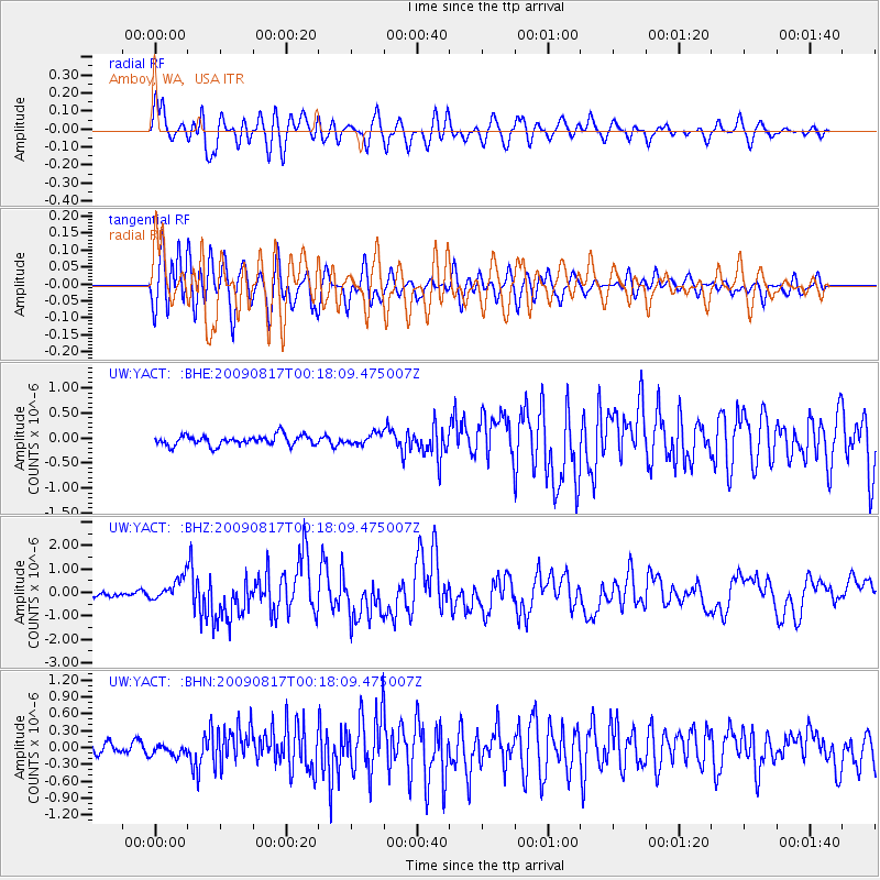
YACT Amboy, WA, USA - Earthquake Result Viewer
*The percent match for this event was below the threshold and hence no stack was calculated.
| Earthquake location: |
Southwestern Ryukyu Isl., Japan |
| Earthquake latitude/longitude: |
23.5/123.5 |
| Earthquake time(UTC): |
2009/08/17 (229) 00:05:49 GMT |
| Earthquake Depth: |
20 km |
| Earthquake Magnitude: |
6.2 MB, 6.6 MS, 6.7 MW, 6.6 MW |
| Earthquake Catalog/Contributor: |
WHDF/NEIC |
|
| Network: |
UW Pacific Northwest Regional Seismic Network |
| Station: |
YACT Amboy, WA, USA |
| Lat/Lon: |
45.93 N/122.42 W |
| Elevation: |
211 m |
|
| Distance: |
88.7 deg |
| Az: |
39.593 deg |
| Baz: |
303.035 deg |
| Ray Param: |
$rayparam |
*The percent match for this event was below the threshold and hence was not used in the summary stack. |
|
| Radial Match: |
85.29565 % |
| Radial Bump: |
400 |
| Transverse Match: |
69.86971 % |
| Transverse Bump: |
400 |
| SOD ConfigId: |
2622 |
| Insert Time: |
2010-02-27 05:23:38.783 +0000 |
| GWidth: |
2.5 |
| Max Bumps: |
400 |
| Tol: |
0.001 |
|
Signal To Noise
| Channel | StoN | STA | LTA |
| UW:YACT: :BHZ:20090817T00:18:09.475007Z | 4.546141 | 4.869465E-7 | 1.0711205E-7 |
| UW:YACT: :BHN:20090817T00:18:09.475007Z | 0.87910324 | 1.0118884E-7 | 1.1510461E-7 |
| UW:YACT: :BHE:20090817T00:18:09.475007Z | 1.0824028 | 1.0739872E-7 | 9.9222504E-8 |
| Arrivals |
| Ps | |
| PpPs | |
| PsPs/PpSs | |


