You are here: Home > Network List > UW - Pacific Northwest Regional Seismic Network Stations List
> Station YACT Amboy, WA, USA > Earthquake Result Viewer
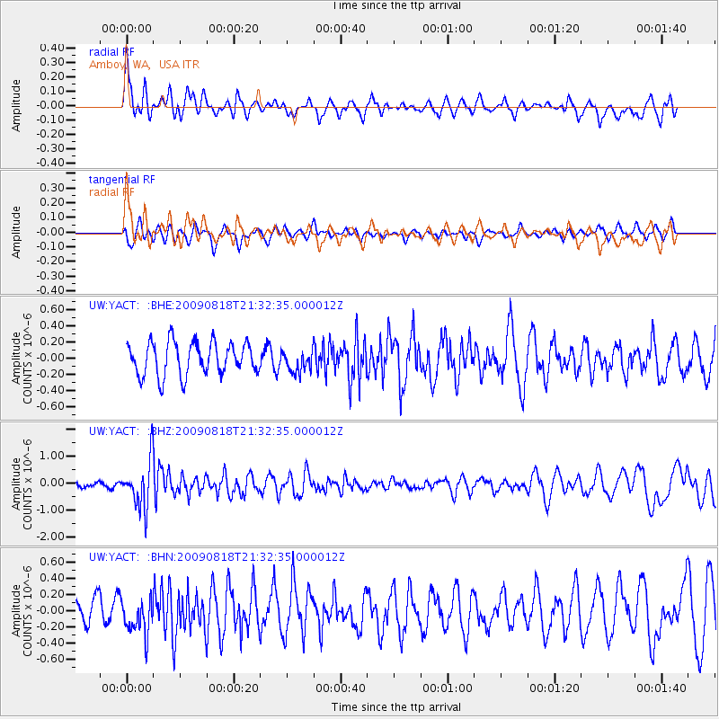
YACT Amboy, WA, USA - Earthquake Result Viewer
*The percent match for this event was below the threshold and hence no stack was calculated.
| Earthquake location: |
South Of Fiji Islands |
| Earthquake latitude/longitude: |
-26.1/-178.4 |
| Earthquake time(UTC): |
2009/08/18 (230) 21:20:47 GMT |
| Earthquake Depth: |
270 km |
| Earthquake Magnitude: |
5.5 MB, 6.3 MW, 6.3 MW |
| Earthquake Catalog/Contributor: |
WHDF/NEIC |
|
| Network: |
UW Pacific Northwest Regional Seismic Network |
| Station: |
YACT Amboy, WA, USA |
| Lat/Lon: |
45.93 N/122.42 W |
| Elevation: |
211 m |
|
| Distance: |
87.8 deg |
| Az: |
35.368 deg |
| Baz: |
228.244 deg |
| Ray Param: |
$rayparam |
*The percent match for this event was below the threshold and hence was not used in the summary stack. |
|
| Radial Match: |
60.334423 % |
| Radial Bump: |
400 |
| Transverse Match: |
33.64518 % |
| Transverse Bump: |
368 |
| SOD ConfigId: |
2622 |
| Insert Time: |
2010-02-27 05:23:40.208 +0000 |
| GWidth: |
2.5 |
| Max Bumps: |
400 |
| Tol: |
0.001 |
|
Signal To Noise
| Channel | StoN | STA | LTA |
| UW:YACT: :BHZ:20090818T21:32:35.000012Z | 5.3794265 | 8.8300686E-7 | 1.6414518E-7 |
| UW:YACT: :BHN:20090818T21:32:35.000012Z | 1.4139457 | 2.2439676E-7 | 1.5870253E-7 |
| UW:YACT: :BHE:20090818T21:32:35.000012Z | 0.64574325 | 1.3131394E-7 | 2.0335318E-7 |
| Arrivals |
| Ps | |
| PpPs | |
| PsPs/PpSs | |


