You are here: Home > Network List > IU - Global Seismograph Network (GSN - IRIS/USGS) Stations List
> Station RSSD Black Hills, South Dakota, USA > Earthquake Result Viewer
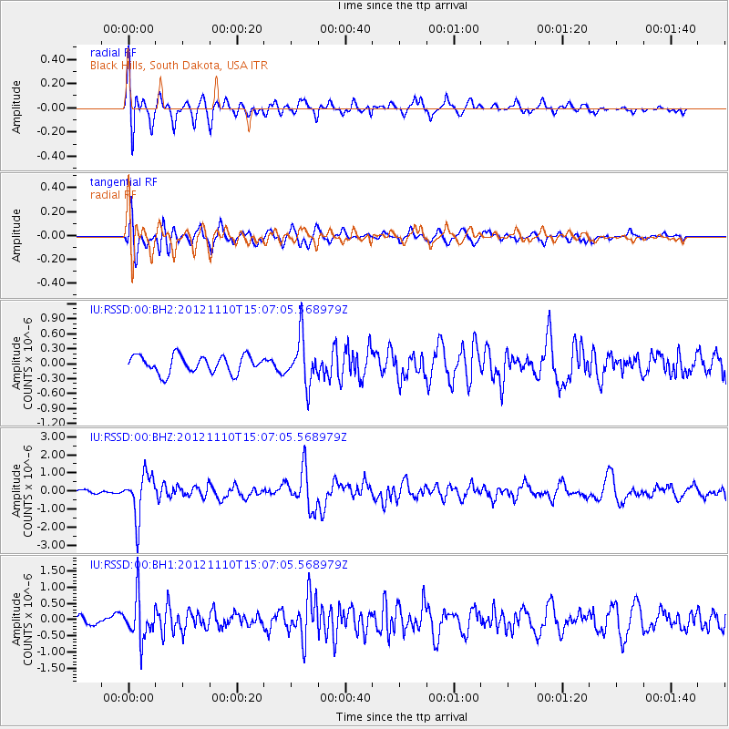
RSSD Black Hills, South Dakota, USA - Earthquake Result Viewer
*The percent match for this event was below the threshold and hence no stack was calculated.
| Earthquake location: |
Central Peru |
| Earthquake latitude/longitude: |
-8.9/-75.1 |
| Earthquake time(UTC): |
2012/11/10 (315) 14:57:50 GMT |
| Earthquake Depth: |
129 km |
| Earthquake Magnitude: |
6.0 MW, 5.9 MB, 6.0 MW |
| Earthquake Catalog/Contributor: |
NEIC PDE/NEIC PDE-W |
|
| Network: |
IU Global Seismograph Network (GSN - IRIS/USGS) |
| Station: |
RSSD Black Hills, South Dakota, USA |
| Lat/Lon: |
44.12 N/104.04 W |
| Elevation: |
2090 m |
|
| Distance: |
58.9 deg |
| Az: |
335.965 deg |
| Baz: |
146.023 deg |
| Ray Param: |
$rayparam |
*The percent match for this event was below the threshold and hence was not used in the summary stack. |
|
| Radial Match: |
63.736855 % |
| Radial Bump: |
400 |
| Transverse Match: |
72.40686 % |
| Transverse Bump: |
400 |
| SOD ConfigId: |
558545 |
| Insert Time: |
2013-09-17 22:57:54.313 +0000 |
| GWidth: |
2.5 |
| Max Bumps: |
400 |
| Tol: |
0.001 |
|
Signal To Noise
| Channel | StoN | STA | LTA |
| IU:RSSD:00:BHZ:20121110T15:07:05.568979Z | 6.0587034 | 1.2192679E-6 | 2.0124239E-7 |
| IU:RSSD:00:BH1:20121110T15:07:05.568979Z | 3.3385816 | 6.571653E-7 | 1.9683965E-7 |
| IU:RSSD:00:BH2:20121110T15:07:05.568979Z | 2.6833916 | 4.6646824E-7 | 1.7383532E-7 |
| Arrivals |
| Ps | |
| PpPs | |
| PsPs/PpSs | |


