You are here: Home > Network List > US - United States National Seismic Network Stations List
> Station ACSO Alum Creek State Park, Ohio, USA > Earthquake Result Viewer
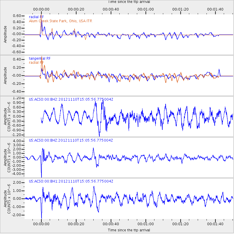
ACSO Alum Creek State Park, Ohio, USA - Earthquake Result Viewer
*The percent match for this event was below the threshold and hence no stack was calculated.
| Earthquake location: |
Central Peru |
| Earthquake latitude/longitude: |
-8.9/-75.1 |
| Earthquake time(UTC): |
2012/11/10 (315) 14:57:50 GMT |
| Earthquake Depth: |
129 km |
| Earthquake Magnitude: |
6.0 MW, 5.9 MB, 6.0 MW |
| Earthquake Catalog/Contributor: |
NEIC PDE/NEIC PDE-W |
|
| Network: |
US United States National Seismic Network |
| Station: |
ACSO Alum Creek State Park, Ohio, USA |
| Lat/Lon: |
40.23 N/82.98 W |
| Elevation: |
288 m |
|
| Distance: |
49.4 deg |
| Az: |
352.022 deg |
| Baz: |
169.68 deg |
| Ray Param: |
$rayparam |
*The percent match for this event was below the threshold and hence was not used in the summary stack. |
|
| Radial Match: |
62.1021 % |
| Radial Bump: |
400 |
| Transverse Match: |
56.09677 % |
| Transverse Bump: |
400 |
| SOD ConfigId: |
558545 |
| Insert Time: |
2013-09-17 22:58:38.674 +0000 |
| GWidth: |
2.5 |
| Max Bumps: |
400 |
| Tol: |
0.001 |
|
Signal To Noise
| Channel | StoN | STA | LTA |
| US:ACSO:00:BHZ:20121110T15:05:56.775004Z | 5.855848 | 1.4258433E-6 | 2.434905E-7 |
| US:ACSO:00:BH1:20121110T15:05:56.775004Z | 1.9610378 | 7.306932E-7 | 3.7260537E-7 |
| US:ACSO:00:BH2:20121110T15:05:56.775004Z | 2.050421 | 6.531795E-7 | 3.1855873E-7 |
| Arrivals |
| Ps | |
| PpPs | |
| PsPs/PpSs | |


