You are here: Home > Network List > UW - Pacific Northwest Regional Seismic Network Stations List
> Station YACT Amboy, WA, USA > Earthquake Result Viewer
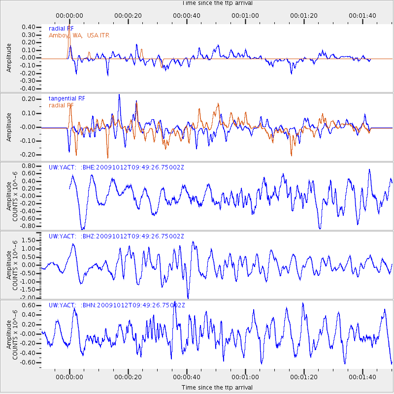
YACT Amboy, WA, USA - Earthquake Result Viewer
*The percent match for this event was below the threshold and hence no stack was calculated.
| Earthquake location: |
Santa Cruz Islands |
| Earthquake latitude/longitude: |
-12.4/166.5 |
| Earthquake time(UTC): |
2009/10/12 (285) 09:37:21 GMT |
| Earthquake Depth: |
42 km |
| Earthquake Magnitude: |
5.9 MB, 5.9 MS, 6.2 MW, 6.2 MW |
| Earthquake Catalog/Contributor: |
WHDF/NEIC |
|
| Network: |
UW Pacific Northwest Regional Seismic Network |
| Station: |
YACT Amboy, WA, USA |
| Lat/Lon: |
45.93 N/122.42 W |
| Elevation: |
211 m |
|
| Distance: |
86.1 deg |
| Az: |
41.434 deg |
| Baz: |
247.866 deg |
| Ray Param: |
$rayparam |
*The percent match for this event was below the threshold and hence was not used in the summary stack. |
|
| Radial Match: |
59.843727 % |
| Radial Bump: |
400 |
| Transverse Match: |
65.62704 % |
| Transverse Bump: |
400 |
| SOD ConfigId: |
2622 |
| Insert Time: |
2010-02-27 05:23:52.666 +0000 |
| GWidth: |
2.5 |
| Max Bumps: |
400 |
| Tol: |
0.001 |
|
Signal To Noise
| Channel | StoN | STA | LTA |
| UW:YACT: :BHZ:20091012T09:49:26.75002Z | 6.276789 | 8.428565E-7 | 1.3428148E-7 |
| UW:YACT: :BHN:20091012T09:49:26.75002Z | 1.653848 | 3.226436E-7 | 1.950866E-7 |
| UW:YACT: :BHE:20091012T09:49:26.75002Z | 0.7806242 | 2.6968522E-7 | 3.454738E-7 |
| Arrivals |
| Ps | |
| PpPs | |
| PsPs/PpSs | |


