You are here: Home > Network List > US - United States National Seismic Network Stations List
> Station ERPA Erie, Pennsylvania, USA > Earthquake Result Viewer
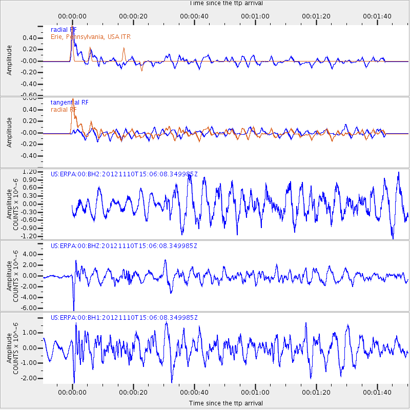
ERPA Erie, Pennsylvania, USA - Earthquake Result Viewer
*The percent match for this event was below the threshold and hence no stack was calculated.
| Earthquake location: |
Central Peru |
| Earthquake latitude/longitude: |
-8.9/-75.1 |
| Earthquake time(UTC): |
2012/11/10 (315) 14:57:50 GMT |
| Earthquake Depth: |
129 km |
| Earthquake Magnitude: |
6.0 MW, 5.9 MB, 6.0 MW |
| Earthquake Catalog/Contributor: |
NEIC PDE/NEIC PDE-W |
|
| Network: |
US United States National Seismic Network |
| Station: |
ERPA Erie, Pennsylvania, USA |
| Lat/Lon: |
42.12 N/79.99 W |
| Elevation: |
306 m |
|
| Distance: |
50.9 deg |
| Az: |
355.288 deg |
| Baz: |
173.736 deg |
| Ray Param: |
$rayparam |
*The percent match for this event was below the threshold and hence was not used in the summary stack. |
|
| Radial Match: |
61.97847 % |
| Radial Bump: |
400 |
| Transverse Match: |
66.82802 % |
| Transverse Bump: |
400 |
| SOD ConfigId: |
558545 |
| Insert Time: |
2013-09-17 22:59:58.174 +0000 |
| GWidth: |
2.5 |
| Max Bumps: |
400 |
| Tol: |
0.001 |
|
Signal To Noise
| Channel | StoN | STA | LTA |
| US:ERPA:00:BHZ:20121110T15:06:08.349985Z | 5.682304 | 1.8363332E-6 | 3.23167E-7 |
| US:ERPA:00:BH1:20121110T15:06:08.349985Z | 2.1985228 | 8.698963E-7 | 3.9567308E-7 |
| US:ERPA:00:BH2:20121110T15:06:08.349985Z | 1.2575043 | 3.6663852E-7 | 2.915604E-7 |
| Arrivals |
| Ps | |
| PpPs | |
| PsPs/PpSs | |


