You are here: Home > Network List > UW - Pacific Northwest Regional Seismic Network Stations List
> Station YACT Amboy, WA, USA > Earthquake Result Viewer
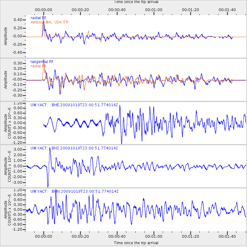
YACT Amboy, WA, USA - Earthquake Result Viewer
*The percent match for this event was below the threshold and hence no stack was calculated.
| Earthquake location: |
Samoa Islands Region |
| Earthquake latitude/longitude: |
-15.4/-172.3 |
| Earthquake time(UTC): |
2009/10/19 (292) 22:49:38 GMT |
| Earthquake Depth: |
18 km |
| Earthquake Magnitude: |
6.2 MB, 5.7 MS, 6.0 MW, 5.9 MW |
| Earthquake Catalog/Contributor: |
WHDF/NEIC |
|
| Network: |
UW Pacific Northwest Regional Seismic Network |
| Station: |
YACT Amboy, WA, USA |
| Lat/Lon: |
45.93 N/122.42 W |
| Elevation: |
211 m |
|
| Distance: |
75.8 deg |
| Az: |
33.386 deg |
| Baz: |
229.522 deg |
| Ray Param: |
$rayparam |
*The percent match for this event was below the threshold and hence was not used in the summary stack. |
|
| Radial Match: |
72.60273 % |
| Radial Bump: |
400 |
| Transverse Match: |
72.07033 % |
| Transverse Bump: |
400 |
| SOD ConfigId: |
2622 |
| Insert Time: |
2010-02-27 05:24:00.048 +0000 |
| GWidth: |
2.5 |
| Max Bumps: |
400 |
| Tol: |
0.001 |
|
Signal To Noise
| Channel | StoN | STA | LTA |
| UW:YACT: :BHZ:20091019T23:00:51.774014Z | 10.784751 | 1.6002936E-6 | 1.4838484E-7 |
| UW:YACT: :BHN:20091019T23:00:51.774014Z | 3.2618093 | 3.646453E-7 | 1.1179234E-7 |
| UW:YACT: :BHE:20091019T23:00:51.774014Z | 1.9447514 | 3.5881533E-7 | 1.8450447E-7 |
| Arrivals |
| Ps | |
| PpPs | |
| PsPs/PpSs | |


