You are here: Home > Network List > US - United States National Seismic Network Stations List
> Station MSO Missoula, Montana, USA > Earthquake Result Viewer
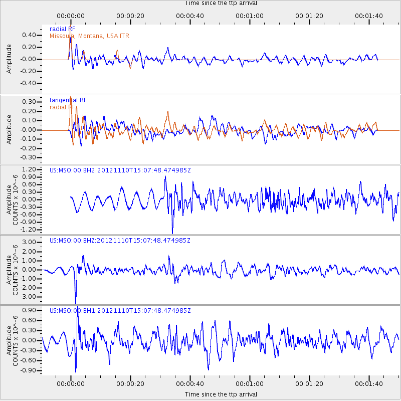
MSO Missoula, Montana, USA - Earthquake Result Viewer
*The percent match for this event was below the threshold and hence no stack was calculated.
| Earthquake location: |
Central Peru |
| Earthquake latitude/longitude: |
-8.9/-75.1 |
| Earthquake time(UTC): |
2012/11/10 (315) 14:57:50 GMT |
| Earthquake Depth: |
129 km |
| Earthquake Magnitude: |
6.0 MW, 5.9 MB, 6.0 MW |
| Earthquake Catalog/Contributor: |
NEIC PDE/NEIC PDE-W |
|
| Network: |
US United States National Seismic Network |
| Station: |
MSO Missoula, Montana, USA |
| Lat/Lon: |
46.83 N/113.94 W |
| Elevation: |
1264 m |
|
| Distance: |
65.4 deg |
| Az: |
331.702 deg |
| Baz: |
136.977 deg |
| Ray Param: |
$rayparam |
*The percent match for this event was below the threshold and hence was not used in the summary stack. |
|
| Radial Match: |
46.691406 % |
| Radial Bump: |
400 |
| Transverse Match: |
57.638702 % |
| Transverse Bump: |
400 |
| SOD ConfigId: |
558545 |
| Insert Time: |
2013-09-17 23:01:02.708 +0000 |
| GWidth: |
2.5 |
| Max Bumps: |
400 |
| Tol: |
0.001 |
|
Signal To Noise
| Channel | StoN | STA | LTA |
| US:MSO:00:BHZ:20121110T15:07:48.474985Z | 7.867672 | 1.0807493E-6 | 1.3736583E-7 |
| US:MSO:00:BH1:20121110T15:07:48.474985Z | 2.3859901 | 4.183475E-7 | 1.7533496E-7 |
| US:MSO:00:BH2:20121110T15:07:48.474985Z | 1.8920892 | 4.5091747E-7 | 2.3831723E-7 |
| Arrivals |
| Ps | |
| PpPs | |
| PsPs/PpSs | |


