You are here: Home > Network List > IU - Global Seismograph Network (GSN - IRIS/USGS) Stations List
> Station MAJO Matsushiro, Japan > Earthquake Result Viewer
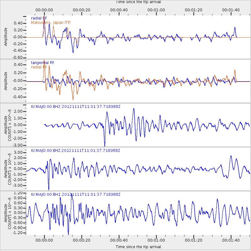
MAJO Matsushiro, Japan - Earthquake Result Viewer
*The percent match for this event was below the threshold and hence no stack was calculated.
| Earthquake location: |
Myanmar |
| Earthquake latitude/longitude: |
22.7/95.8 |
| Earthquake time(UTC): |
2012/11/11 (316) 10:54:41 GMT |
| Earthquake Depth: |
6.0 km |
| Earthquake Magnitude: |
5.8 MW, 5.7 MB, 5.7 MW, 5.8 MS |
| Earthquake Catalog/Contributor: |
NEIC PDE/NEIC PDE-W |
|
| Network: |
IU Global Seismograph Network (GSN - IRIS/USGS) |
| Station: |
MAJO Matsushiro, Japan |
| Lat/Lon: |
36.55 N/138.20 E |
| Elevation: |
405 m |
|
| Distance: |
39.0 deg |
| Az: |
59.558 deg |
| Baz: |
261.304 deg |
| Ray Param: |
$rayparam |
*The percent match for this event was below the threshold and hence was not used in the summary stack. |
|
| Radial Match: |
69.774826 % |
| Radial Bump: |
398 |
| Transverse Match: |
44.254715 % |
| Transverse Bump: |
400 |
| SOD ConfigId: |
558545 |
| Insert Time: |
2013-09-17 23:07:08.428 +0000 |
| GWidth: |
2.5 |
| Max Bumps: |
400 |
| Tol: |
0.001 |
|
Signal To Noise
| Channel | StoN | STA | LTA |
| IU:MAJO:00:BHZ:20121111T11:01:37.718988Z | 8.658939 | 1.3619938E-6 | 1.5729337E-7 |
| IU:MAJO:00:BH1:20121111T11:01:37.718988Z | 1.1237893 | 3.8127462E-7 | 3.3927589E-7 |
| IU:MAJO:00:BH2:20121111T11:01:37.718988Z | 5.2151785 | 1.1506509E-6 | 2.20635E-7 |
| Arrivals |
| Ps | |
| PpPs | |
| PsPs/PpSs | |


