You are here: Home > Network List > UW - Pacific Northwest Regional Seismic Network Stations List
> Station YACT Amboy, WA, USA > Earthquake Result Viewer
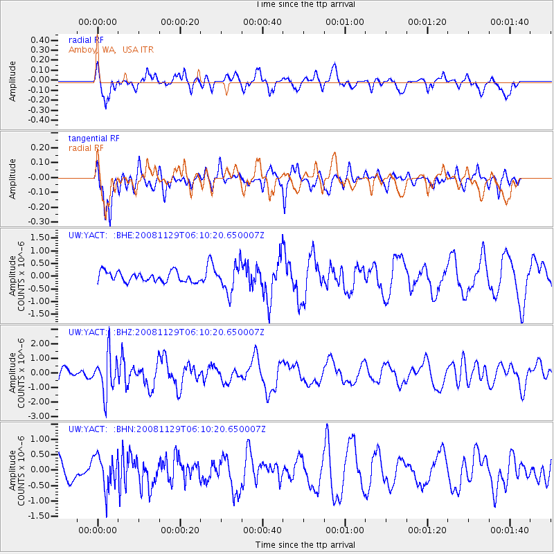
YACT Amboy, WA, USA - Earthquake Result Viewer
*The percent match for this event was below the threshold and hence no stack was calculated.
| Earthquake location: |
Fiji Islands Region |
| Earthquake latitude/longitude: |
-18.7/-177.7 |
| Earthquake time(UTC): |
2008/11/29 (334) 05:59:16 GMT |
| Earthquake Depth: |
386 km |
| Earthquake Magnitude: |
5.7 MB, 6.0 MW, 5.9 MW |
| Earthquake Catalog/Contributor: |
WHDF/NEIC |
|
| Network: |
UW Pacific Northwest Regional Seismic Network |
| Station: |
YACT Amboy, WA, USA |
| Lat/Lon: |
45.93 N/122.42 W |
| Elevation: |
211 m |
|
| Distance: |
81.5 deg |
| Az: |
35.464 deg |
| Baz: |
231.996 deg |
| Ray Param: |
$rayparam |
*The percent match for this event was below the threshold and hence was not used in the summary stack. |
|
| Radial Match: |
51.69347 % |
| Radial Bump: |
400 |
| Transverse Match: |
64.62775 % |
| Transverse Bump: |
400 |
| SOD ConfigId: |
2658 |
| Insert Time: |
2010-02-27 05:24:18.098 +0000 |
| GWidth: |
2.5 |
| Max Bumps: |
400 |
| Tol: |
0.001 |
|
Signal To Noise
| Channel | StoN | STA | LTA |
| UW:YACT: :BHZ:20081129T06:10:20.650007Z | 3.6375556 | 1.3816941E-6 | 3.7984137E-7 |
| UW:YACT: :BHN:20081129T06:10:20.650007Z | 1.2525688 | 5.425356E-7 | 4.3313838E-7 |
| UW:YACT: :BHE:20081129T06:10:20.650007Z | 2.900295 | 5.588232E-7 | 1.9267806E-7 |
| Arrivals |
| Ps | |
| PpPs | |
| PsPs/PpSs | |


