You are here: Home > Network List > US - United States National Seismic Network Stations List
> Station VBMS Vicksburg, Mississippi > Earthquake Result Viewer
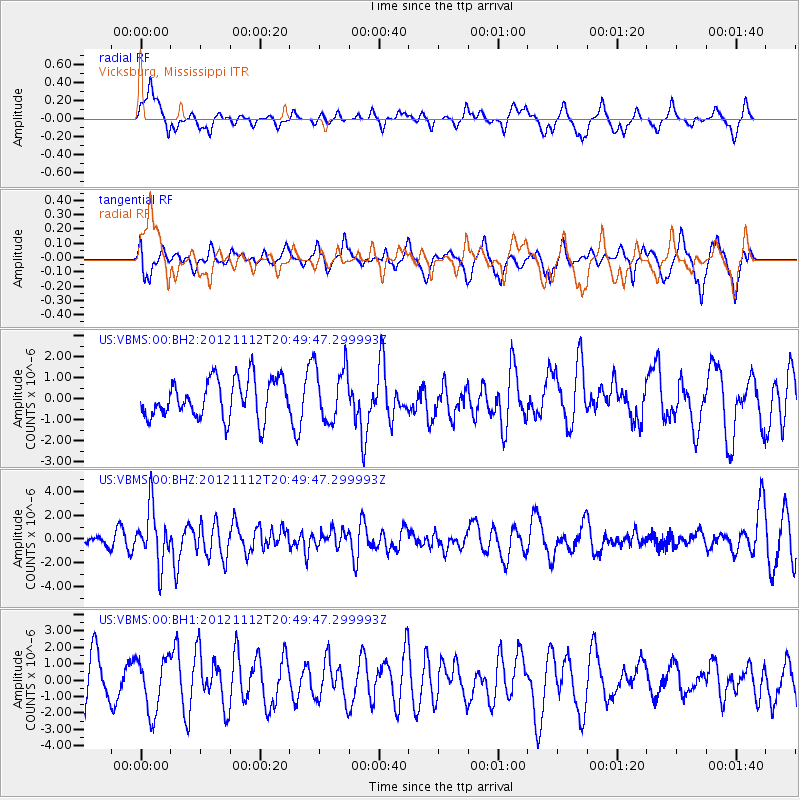
VBMS Vicksburg, Mississippi - Earthquake Result Viewer
*The percent match for this event was below the threshold and hence no stack was calculated.
| Earthquake location: |
Gulf Of Alaska |
| Earthquake latitude/longitude: |
57.8/-142.9 |
| Earthquake time(UTC): |
2012/11/12 (317) 20:42:14 GMT |
| Earthquake Depth: |
9.0 km |
| Earthquake Magnitude: |
6.3 MW, 6.0 MB, 6.2 MS, 6.3 MW |
| Earthquake Catalog/Contributor: |
NEIC PDE/NEIC PDE-W |
|
| Network: |
US United States National Seismic Network |
| Station: |
VBMS Vicksburg, Mississippi |
| Lat/Lon: |
32.22 N/90.52 W |
| Elevation: |
0.0 m |
|
| Distance: |
43.5 deg |
| Az: |
102.862 deg |
| Baz: |
321.977 deg |
| Ray Param: |
$rayparam |
*The percent match for this event was below the threshold and hence was not used in the summary stack. |
|
| Radial Match: |
51.04951 % |
| Radial Bump: |
330 |
| Transverse Match: |
54.3607 % |
| Transverse Bump: |
391 |
| SOD ConfigId: |
558545 |
| Insert Time: |
2013-09-17 23:17:04.668 +0000 |
| GWidth: |
2.5 |
| Max Bumps: |
400 |
| Tol: |
0.001 |
|
Signal To Noise
| Channel | StoN | STA | LTA |
| US:VBMS:00:BHZ:20121112T20:49:47.299993Z | 5.081762 | 2.3196653E-6 | 4.5646868E-7 |
| US:VBMS:00:BH1:20121112T20:49:47.299993Z | 1.2112418 | 1.6678606E-6 | 1.3769841E-6 |
| US:VBMS:00:BH2:20121112T20:49:47.299993Z | 1.4133612 | 1.3104293E-6 | 9.2717227E-7 |
| Arrivals |
| Ps | |
| PpPs | |
| PsPs/PpSs | |


