You are here: Home > Network List > IU - Global Seismograph Network (GSN - IRIS/USGS) Stations List
> Station PMG Port Moresby, New Guinea > Earthquake Result Viewer
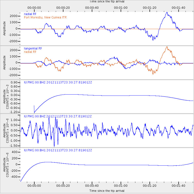
PMG Port Moresby, New Guinea - Earthquake Result Viewer
*The percent match for this event was below the threshold and hence no stack was calculated.
| Earthquake location: |
Tonga Islands |
| Earthquake latitude/longitude: |
-21.0/-175.9 |
| Earthquake time(UTC): |
2012/11/13 (318) 23:23:48 GMT |
| Earthquake Depth: |
24 km |
| Earthquake Magnitude: |
5.6 MW |
| Earthquake Catalog/Contributor: |
NEIC PDE/NEIC PDE-W |
|
| Network: |
IU Global Seismograph Network (GSN - IRIS/USGS) |
| Station: |
PMG Port Moresby, New Guinea |
| Lat/Lon: |
9.40 S/147.16 E |
| Elevation: |
90 m |
|
| Distance: |
37.3 deg |
| Az: |
282.375 deg |
| Baz: |
112.38 deg |
| Ray Param: |
$rayparam |
*The percent match for this event was below the threshold and hence was not used in the summary stack. |
|
| Radial Match: |
17.695906 % |
| Radial Bump: |
400 |
| Transverse Match: |
16.189846 % |
| Transverse Bump: |
400 |
| SOD ConfigId: |
558545 |
| Insert Time: |
2013-09-17 23:22:17.502 +0000 |
| GWidth: |
2.5 |
| Max Bumps: |
400 |
| Tol: |
0.001 |
|
Signal To Noise
| Channel | StoN | STA | LTA |
| IU:PMG:00:BHZ:20121113T23:30:27.819012Z | 2.3136795 | 5.40793E-7 | 2.3373724E-7 |
| IU:PMG:00:BH1:20121113T23:30:27.819012Z | 0.24061573 | 3.709329E-4 | 0.0015415987 |
| IU:PMG:00:BH2:20121113T23:30:27.819012Z | 0.9139626 | 3.4985886E-4 | 3.827934E-4 |
| Arrivals |
| Ps | |
| PpPs | |
| PsPs/PpSs | |


