You are here: Home > Network List > US - United States National Seismic Network Stations List
> Station ELK Elko, Nevada, USA > Earthquake Result Viewer
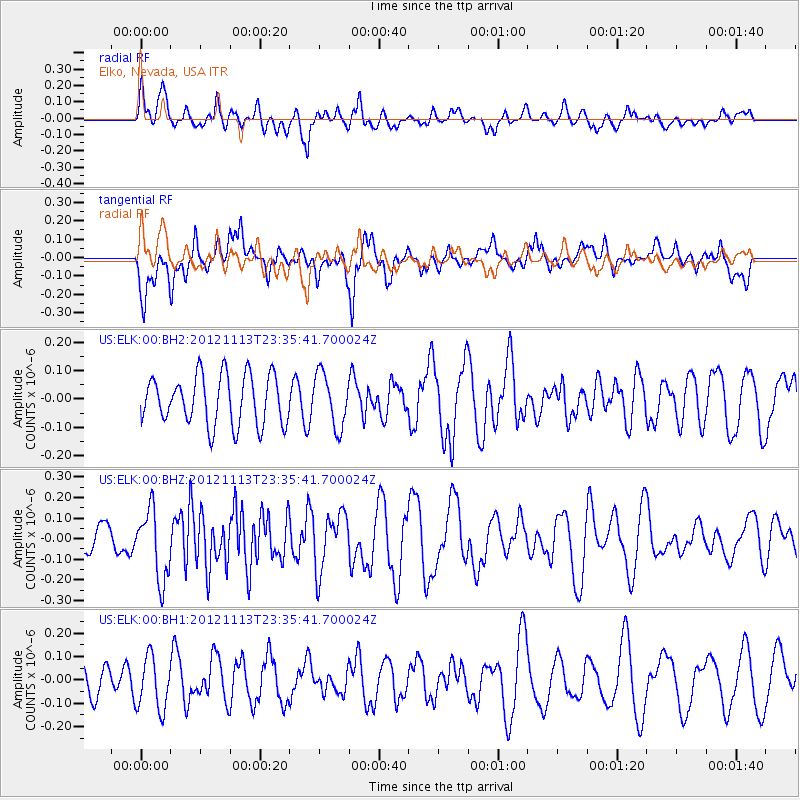
ELK Elko, Nevada, USA - Earthquake Result Viewer
*The percent match for this event was below the threshold and hence no stack was calculated.
| Earthquake location: |
Tonga Islands |
| Earthquake latitude/longitude: |
-21.0/-175.9 |
| Earthquake time(UTC): |
2012/11/13 (318) 23:23:48 GMT |
| Earthquake Depth: |
24 km |
| Earthquake Magnitude: |
5.6 MW |
| Earthquake Catalog/Contributor: |
NEIC PDE/NEIC PDE-W |
|
| Network: |
US United States National Seismic Network |
| Station: |
ELK Elko, Nevada, USA |
| Lat/Lon: |
40.74 N/115.24 W |
| Elevation: |
2210 m |
|
| Distance: |
83.4 deg |
| Az: |
41.836 deg |
| Baz: |
235.089 deg |
| Ray Param: |
$rayparam |
*The percent match for this event was below the threshold and hence was not used in the summary stack. |
|
| Radial Match: |
59.240223 % |
| Radial Bump: |
400 |
| Transverse Match: |
60.214344 % |
| Transverse Bump: |
400 |
| SOD ConfigId: |
558545 |
| Insert Time: |
2013-09-17 23:22:59.520 +0000 |
| GWidth: |
2.5 |
| Max Bumps: |
400 |
| Tol: |
0.001 |
|
Signal To Noise
| Channel | StoN | STA | LTA |
| US:ELK:00:BHZ:20121113T23:35:41.700024Z | 2.718124 | 1.7087278E-7 | 6.286424E-8 |
| US:ELK:00:BH1:20121113T23:35:41.700024Z | 2.1203187 | 1.1373303E-7 | 5.363959E-8 |
| US:ELK:00:BH2:20121113T23:35:41.700024Z | 1.0788877 | 9.421038E-8 | 8.732176E-8 |
| Arrivals |
| Ps | |
| PpPs | |
| PsPs/PpSs | |


