You are here: Home > Network List > US - United States National Seismic Network Stations List
> Station MIAR Mount Ida, Arkansas, USA > Earthquake Result Viewer
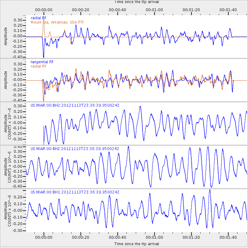
MIAR Mount Ida, Arkansas, USA - Earthquake Result Viewer
*The percent match for this event was below the threshold and hence no stack was calculated.
| Earthquake location: |
Tonga Islands |
| Earthquake latitude/longitude: |
-21.0/-175.9 |
| Earthquake time(UTC): |
2012/11/13 (318) 23:23:48 GMT |
| Earthquake Depth: |
24 km |
| Earthquake Magnitude: |
5.6 MW |
| Earthquake Catalog/Contributor: |
NEIC PDE/NEIC PDE-W |
|
| Network: |
US United States National Seismic Network |
| Station: |
MIAR Mount Ida, Arkansas, USA |
| Lat/Lon: |
34.55 N/93.58 W |
| Elevation: |
207 m |
|
| Distance: |
95.7 deg |
| Az: |
55.301 deg |
| Baz: |
248.495 deg |
| Ray Param: |
$rayparam |
*The percent match for this event was below the threshold and hence was not used in the summary stack. |
|
| Radial Match: |
62.5878 % |
| Radial Bump: |
400 |
| Transverse Match: |
58.814503 % |
| Transverse Bump: |
400 |
| SOD ConfigId: |
558545 |
| Insert Time: |
2013-09-17 23:23:14.784 +0000 |
| GWidth: |
2.5 |
| Max Bumps: |
400 |
| Tol: |
0.001 |
|
Signal To Noise
| Channel | StoN | STA | LTA |
| US:MIAR:00:BHZ:20121113T23:36:39.950024Z | 0.79646885 | 1.3604107E-7 | 1.7080524E-7 |
| US:MIAR:00:BH1:20121113T23:36:39.950024Z | 0.850004 | 6.793498E-8 | 7.9923126E-8 |
| US:MIAR:00:BH2:20121113T23:36:39.950024Z | 1.106168 | 1.6461813E-7 | 1.4881837E-7 |
| Arrivals |
| Ps | |
| PpPs | |
| PsPs/PpSs | |


