You are here: Home > Network List > UW - Pacific Northwest Regional Seismic Network Stations List
> Station YACT Amboy, WA, USA > Earthquake Result Viewer
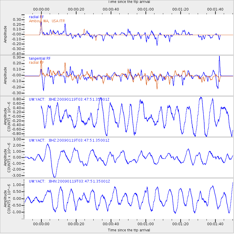
YACT Amboy, WA, USA - Earthquake Result Viewer
*The percent match for this event was below the threshold and hence no stack was calculated.
| Earthquake location: |
Southeast Of Loyalty Islands |
| Earthquake latitude/longitude: |
-22.6/170.9 |
| Earthquake time(UTC): |
2009/01/19 (019) 03:35:18 GMT |
| Earthquake Depth: |
12 km |
| Earthquake Magnitude: |
5.7 MB, 6.4 MS, 6.5 MW, 6.5 MW |
| Earthquake Catalog/Contributor: |
WHDF/NEIC |
|
| Network: |
UW Pacific Northwest Regional Seismic Network |
| Station: |
YACT Amboy, WA, USA |
| Lat/Lon: |
45.93 N/122.42 W |
| Elevation: |
211 m |
|
| Distance: |
91.0 deg |
| Az: |
39.863 deg |
| Baz: |
238.073 deg |
| Ray Param: |
$rayparam |
*The percent match for this event was below the threshold and hence was not used in the summary stack. |
|
| Radial Match: |
51.720192 % |
| Radial Bump: |
367 |
| Transverse Match: |
58.83799 % |
| Transverse Bump: |
400 |
| SOD ConfigId: |
2658 |
| Insert Time: |
2010-02-27 05:25:14.216 +0000 |
| GWidth: |
2.5 |
| Max Bumps: |
400 |
| Tol: |
0.001 |
|
Signal To Noise
| Channel | StoN | STA | LTA |
| UW:YACT: :BHZ:20090119T03:47:51.35001Z | 4.862823 | 1.2658105E-6 | 2.6030364E-7 |
| UW:YACT: :BHN:20090119T03:47:51.35001Z | 1.1029763 | 3.7486203E-7 | 3.3986407E-7 |
| UW:YACT: :BHE:20090119T03:47:51.35001Z | 1.699969 | 5.1333814E-7 | 3.019691E-7 |
| Arrivals |
| Ps | |
| PpPs | |
| PsPs/PpSs | |


