You are here: Home > Network List > UW - Pacific Northwest Regional Seismic Network Stations List
> Station YACT Amboy, WA, USA > Earthquake Result Viewer
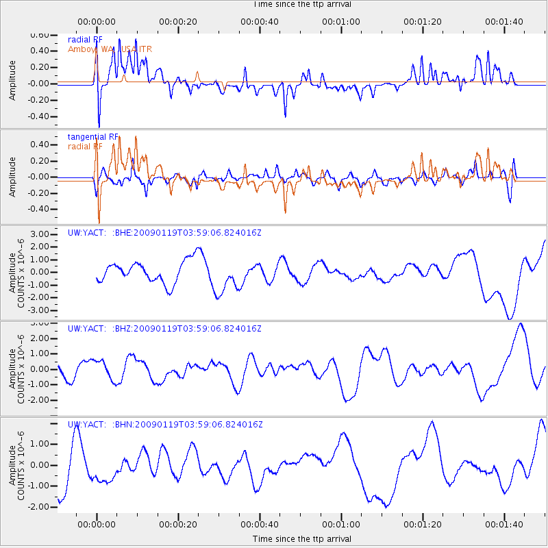
YACT Amboy, WA, USA - Earthquake Result Viewer
*The percent match for this event was below the threshold and hence no stack was calculated.
| Earthquake location: |
Southeast Of Loyalty Islands |
| Earthquake latitude/longitude: |
-22.5/170.8 |
| Earthquake time(UTC): |
2009/01/19 (019) 03:46:37 GMT |
| Earthquake Depth: |
35 km |
| Earthquake Magnitude: |
6.0 MW, 5.3 MB |
| Earthquake Catalog/Contributor: |
WHDF/NEIC |
|
| Network: |
UW Pacific Northwest Regional Seismic Network |
| Station: |
YACT Amboy, WA, USA |
| Lat/Lon: |
45.93 N/122.42 W |
| Elevation: |
211 m |
|
| Distance: |
91.0 deg |
| Az: |
39.9 deg |
| Baz: |
238.224 deg |
| Ray Param: |
$rayparam |
*The percent match for this event was below the threshold and hence was not used in the summary stack. |
|
| Radial Match: |
60.238686 % |
| Radial Bump: |
400 |
| Transverse Match: |
50.30946 % |
| Transverse Bump: |
400 |
| SOD ConfigId: |
2658 |
| Insert Time: |
2010-02-27 05:25:15.977 +0000 |
| GWidth: |
2.5 |
| Max Bumps: |
400 |
| Tol: |
0.001 |
|
Signal To Noise
| Channel | StoN | STA | LTA |
| UW:YACT: :BHZ:20090119T03:59:06.824016Z | 1.2844257 | 6.456777E-7 | 5.0269756E-7 |
| UW:YACT: :BHN:20090119T03:59:06.824016Z | 0.93207496 | 6.844258E-7 | 7.3430334E-7 |
| UW:YACT: :BHE:20090119T03:59:06.824016Z | 1.6506627 | 1.3884418E-6 | 8.411421E-7 |
| Arrivals |
| Ps | |
| PpPs | |
| PsPs/PpSs | |


