You are here: Home > Network List > II - Global Seismograph Network (GSN - IRIS/IDA) Stations List
> Station CMLA Cha de Macela, Sao Miguel Island, Azores > Earthquake Result Viewer
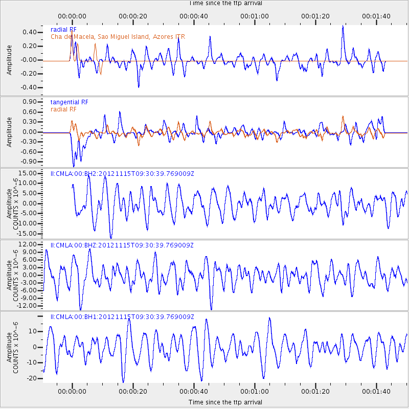
CMLA Cha de Macela, Sao Miguel Island, Azores - Earthquake Result Viewer
*The percent match for this event was below the threshold and hence no stack was calculated.
| Earthquake location: |
Guerrero, Mexico |
| Earthquake latitude/longitude: |
18.3/-100.4 |
| Earthquake time(UTC): |
2012/11/15 (320) 09:20:21 GMT |
| Earthquake Depth: |
53 km |
| Earthquake Magnitude: |
6.1 MW, 5.7 MB, 6.1 MW |
| Earthquake Catalog/Contributor: |
NEIC PDE/NEIC PDE-W |
|
| Network: |
II Global Seismograph Network (GSN - IRIS/IDA) |
| Station: |
CMLA Cha de Macela, Sao Miguel Island, Azores |
| Lat/Lon: |
37.76 N/25.52 W |
| Elevation: |
429 m |
|
| Distance: |
67.2 deg |
| Az: |
56.08 deg |
| Baz: |
276.017 deg |
| Ray Param: |
$rayparam |
*The percent match for this event was below the threshold and hence was not used in the summary stack. |
|
| Radial Match: |
51.130383 % |
| Radial Bump: |
312 |
| Transverse Match: |
61.567886 % |
| Transverse Bump: |
400 |
| SOD ConfigId: |
558545 |
| Insert Time: |
2013-09-17 23:36:53.671 +0000 |
| GWidth: |
2.5 |
| Max Bumps: |
400 |
| Tol: |
0.001 |
|
Signal To Noise
| Channel | StoN | STA | LTA |
| II:CMLA:00:BHZ:20121115T09:30:39.769009Z | 1.6858352 | 6.648694E-6 | 3.943858E-6 |
| II:CMLA:00:BH1:20121115T09:30:39.769009Z | 0.7225886 | 5.2150363E-6 | 7.2171583E-6 |
| II:CMLA:00:BH2:20121115T09:30:39.769009Z | 0.8403273 | 5.9742965E-6 | 7.1094873E-6 |
| Arrivals |
| Ps | |
| PpPs | |
| PsPs/PpSs | |


