You are here: Home > Network List > US - United States National Seismic Network Stations List
> Station HAWA Hanford, Washington, USA > Earthquake Result Viewer
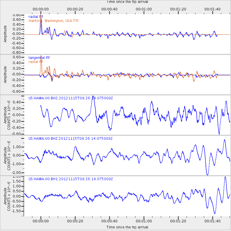
HAWA Hanford, Washington, USA - Earthquake Result Viewer
*The percent match for this event was below the threshold and hence no stack was calculated.
| Earthquake location: |
Guerrero, Mexico |
| Earthquake latitude/longitude: |
18.3/-100.4 |
| Earthquake time(UTC): |
2012/11/15 (320) 09:20:21 GMT |
| Earthquake Depth: |
53 km |
| Earthquake Magnitude: |
6.1 MW, 5.7 MB, 6.1 MW |
| Earthquake Catalog/Contributor: |
NEIC PDE/NEIC PDE-W |
|
| Network: |
US United States National Seismic Network |
| Station: |
HAWA Hanford, Washington, USA |
| Lat/Lon: |
46.39 N/119.53 W |
| Elevation: |
364 m |
|
| Distance: |
32.1 deg |
| Az: |
334.729 deg |
| Baz: |
144.139 deg |
| Ray Param: |
$rayparam |
*The percent match for this event was below the threshold and hence was not used in the summary stack. |
|
| Radial Match: |
79.50554 % |
| Radial Bump: |
400 |
| Transverse Match: |
54.081562 % |
| Transverse Bump: |
400 |
| SOD ConfigId: |
558545 |
| Insert Time: |
2013-09-17 23:38:51.882 +0000 |
| GWidth: |
2.5 |
| Max Bumps: |
400 |
| Tol: |
0.001 |
|
Signal To Noise
| Channel | StoN | STA | LTA |
| US:HAWA:00:BHZ:20121115T09:26:14.075009Z | 2.8990505 | 4.939001E-7 | 1.7036615E-7 |
| US:HAWA:00:BH1:20121115T09:26:14.075009Z | 2.0208316 | 2.7069305E-7 | 1.3395132E-7 |
| US:HAWA:00:BH2:20121115T09:26:14.075009Z | 2.1979373 | 3.351862E-7 | 1.5250035E-7 |
| Arrivals |
| Ps | |
| PpPs | |
| PsPs/PpSs | |


