You are here: Home > Network List > US - United States National Seismic Network Stations List
> Station MNTX Cornudas Mountains, Texas, USA > Earthquake Result Viewer
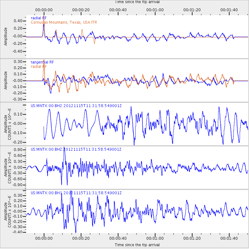
MNTX Cornudas Mountains, Texas, USA - Earthquake Result Viewer
*The percent match for this event was below the threshold and hence no stack was calculated.
| Earthquake location: |
Near Islands, Aleutian Islands |
| Earthquake latitude/longitude: |
52.5/173.4 |
| Earthquake time(UTC): |
2012/11/15 (320) 11:22:22 GMT |
| Earthquake Depth: |
28 km |
| Earthquake Magnitude: |
5.6 MW, 5.5 MW, 5.6 MB |
| Earthquake Catalog/Contributor: |
NEIC PDE/NEIC PDE-W |
|
| Network: |
US United States National Seismic Network |
| Station: |
MNTX Cornudas Mountains, Texas, USA |
| Lat/Lon: |
31.70 N/105.38 W |
| Elevation: |
404 m |
|
| Distance: |
60.5 deg |
| Az: |
75.539 deg |
| Baz: |
316.01 deg |
| Ray Param: |
$rayparam |
*The percent match for this event was below the threshold and hence was not used in the summary stack. |
|
| Radial Match: |
64.939384 % |
| Radial Bump: |
400 |
| Transverse Match: |
50.87984 % |
| Transverse Bump: |
400 |
| SOD ConfigId: |
558545 |
| Insert Time: |
2013-09-17 23:43:20.052 +0000 |
| GWidth: |
2.5 |
| Max Bumps: |
400 |
| Tol: |
0.001 |
|
Signal To Noise
| Channel | StoN | STA | LTA |
| US:MNTX:00:BHZ:20121115T11:31:58.549001Z | 2.091799 | 1.6140433E-7 | 7.7160536E-8 |
| US:MNTX:00:BH1:20121115T11:31:58.549001Z | 1.3039285 | 8.223612E-8 | 6.3067965E-8 |
| US:MNTX:00:BH2:20121115T11:31:58.549001Z | 0.76685023 | 6.502009E-8 | 8.47885E-8 |
| Arrivals |
| Ps | |
| PpPs | |
| PsPs/PpSs | |


