You are here: Home > Network List > US - United States National Seismic Network Stations List
> Station PKME Peaks-Kenny State Park, Maine, USA > Earthquake Result Viewer
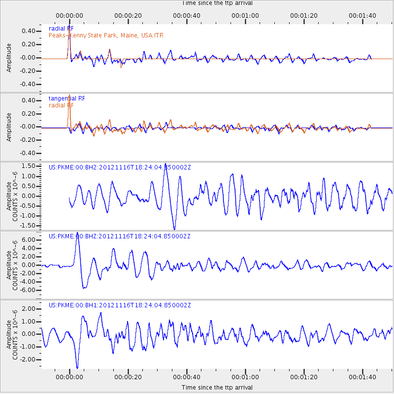
PKME Peaks-Kenny State Park, Maine, USA - Earthquake Result Viewer
*The percent match for this event was below the threshold and hence no stack was calculated.
| Earthquake location: |
Kuril Islands |
| Earthquake latitude/longitude: |
49.3/155.4 |
| Earthquake time(UTC): |
2012/11/16 (321) 18:12:39 GMT |
| Earthquake Depth: |
29 km |
| Earthquake Magnitude: |
6.5 MW, 6.1 MB, 6.3 MS, 6.5 MW |
| Earthquake Catalog/Contributor: |
NEIC PDE/NEIC PDE-W |
|
| Network: |
US United States National Seismic Network |
| Station: |
PKME Peaks-Kenny State Park, Maine, USA |
| Lat/Lon: |
45.26 N/69.29 W |
| Elevation: |
108 m |
|
| Distance: |
78.1 deg |
| Az: |
30.52 deg |
| Baz: |
331.906 deg |
| Ray Param: |
$rayparam |
*The percent match for this event was below the threshold and hence was not used in the summary stack. |
|
| Radial Match: |
72.61035 % |
| Radial Bump: |
400 |
| Transverse Match: |
64.77749 % |
| Transverse Bump: |
400 |
| SOD ConfigId: |
558545 |
| Insert Time: |
2013-09-17 23:52:36.318 +0000 |
| GWidth: |
2.5 |
| Max Bumps: |
400 |
| Tol: |
0.001 |
|
Signal To Noise
| Channel | StoN | STA | LTA |
| US:PKME:00:BHZ:20121116T18:24:04.850002Z | 8.096312 | 3.6652561E-6 | 4.527069E-7 |
| US:PKME:00:BH1:20121116T18:24:04.850002Z | 2.9202042 | 1.2163897E-6 | 4.165427E-7 |
| US:PKME:00:BH2:20121116T18:24:04.850002Z | 2.1790695 | 7.8801014E-7 | 3.6162692E-7 |
| Arrivals |
| Ps | |
| PpPs | |
| PsPs/PpSs | |


