You are here: Home > Network List > II - Global Seismograph Network (GSN - IRIS/IDA) Stations List
> Station WRAB Tennant Creek, NT, Australia > Earthquake Result Viewer
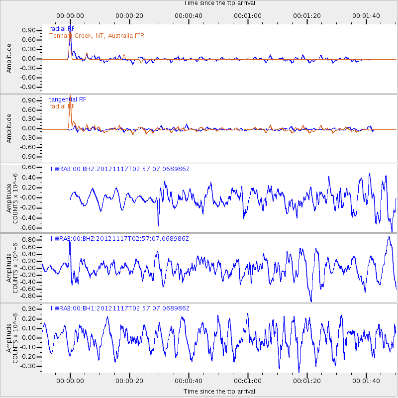
WRAB Tennant Creek, NT, Australia - Earthquake Result Viewer
*The percent match for this event was below the threshold and hence no stack was calculated.
| Earthquake location: |
Vanuatu Islands |
| Earthquake latitude/longitude: |
-15.0/167.5 |
| Earthquake time(UTC): |
2012/11/17 (322) 02:51:23 GMT |
| Earthquake Depth: |
123 km |
| Earthquake Magnitude: |
5.6 MW, 5.5 MB, 5.7 MW |
| Earthquake Catalog/Contributor: |
NEIC PDE/NEIC PDE-W |
|
| Network: |
II Global Seismograph Network (GSN - IRIS/IDA) |
| Station: |
WRAB Tennant Creek, NT, Australia |
| Lat/Lon: |
19.93 S/134.36 E |
| Elevation: |
366 m |
|
| Distance: |
31.9 deg |
| Az: |
256.332 deg |
| Baz: |
86.47 deg |
| Ray Param: |
$rayparam |
*The percent match for this event was below the threshold and hence was not used in the summary stack. |
|
| Radial Match: |
79.65146 % |
| Radial Bump: |
386 |
| Transverse Match: |
35.947304 % |
| Transverse Bump: |
400 |
| SOD ConfigId: |
558545 |
| Insert Time: |
2013-09-17 23:54:02.884 +0000 |
| GWidth: |
2.5 |
| Max Bumps: |
400 |
| Tol: |
0.001 |
|
Signal To Noise
| Channel | StoN | STA | LTA |
| II:WRAB:00:BHZ:20121117T02:57:07.068986Z | 3.2411919 | 3.1293587E-7 | 9.654963E-8 |
| II:WRAB:00:BH1:20121117T02:57:07.068986Z | 1.2675427 | 1.0302311E-7 | 8.127782E-8 |
| II:WRAB:00:BH2:20121117T02:57:07.068986Z | 1.849843 | 1.906424E-7 | 1.0305869E-7 |
| Arrivals |
| Ps | |
| PpPs | |
| PsPs/PpSs | |


