You are here: Home > Network List > TA - USArray Transportable Network (new EarthScope stations) Stations List
> Station O03E Paynes Creek, CA, USA > Earthquake Result Viewer
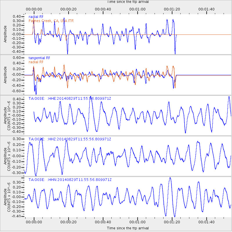
O03E Paynes Creek, CA, USA - Earthquake Result Viewer
*The percent match for this event was below the threshold and hence no stack was calculated.
| Earthquake location: |
South Of Kermadec Islands |
| Earthquake latitude/longitude: |
-32.9/-179.1 |
| Earthquake time(UTC): |
2014/08/29 (241) 11:43:26 GMT |
| Earthquake Depth: |
0.0 km |
| Earthquake Magnitude: |
4.7 mb, 3.8 Ms1, 4.4 mb, 4.5 mb1, 4.2 mb1mx, 4.4 mbtmp, 3.8 MS, 3.6 ms1mx |
| Earthquake Catalog/Contributor: |
ISC/ISC |
|
| Network: |
TA USArray Transportable Network (new EarthScope stations) |
| Station: |
O03E Paynes Creek, CA, USA |
| Lat/Lon: |
40.29 N/121.80 W |
| Elevation: |
967 m |
|
| Distance: |
90.1 deg |
| Az: |
40.053 deg |
| Baz: |
225.024 deg |
| Ray Param: |
$rayparam |
*The percent match for this event was below the threshold and hence was not used in the summary stack. |
|
| Radial Match: |
58.233086 % |
| Radial Bump: |
400 |
| Transverse Match: |
74.85775 % |
| Transverse Bump: |
400 |
| SOD ConfigId: |
3390531 |
| Insert Time: |
2019-04-13 17:00:45.919 +0000 |
| GWidth: |
2.5 |
| Max Bumps: |
400 |
| Tol: |
0.001 |
|
Signal To Noise
| Channel | StoN | STA | LTA |
| TA:O03E: :HHZ:20140829T11:55:56.809971Z | 1.9056163 | 2.4306985E-7 | 1.2755444E-7 |
| TA:O03E: :HHN:20140829T11:55:56.809971Z | 0.8422797 | 1.285067E-7 | 1.5257011E-7 |
| TA:O03E: :HHE:20140829T11:55:56.809971Z | 2.118075 | 2.8783313E-7 | 1.3589374E-7 |
| Arrivals |
| Ps | |
| PpPs | |
| PsPs/PpSs | |


