You are here: Home > Network List > IU - Global Seismograph Network (GSN - IRIS/USGS) Stations List
> Station RSSD Black Hills, South Dakota, USA > Earthquake Result Viewer
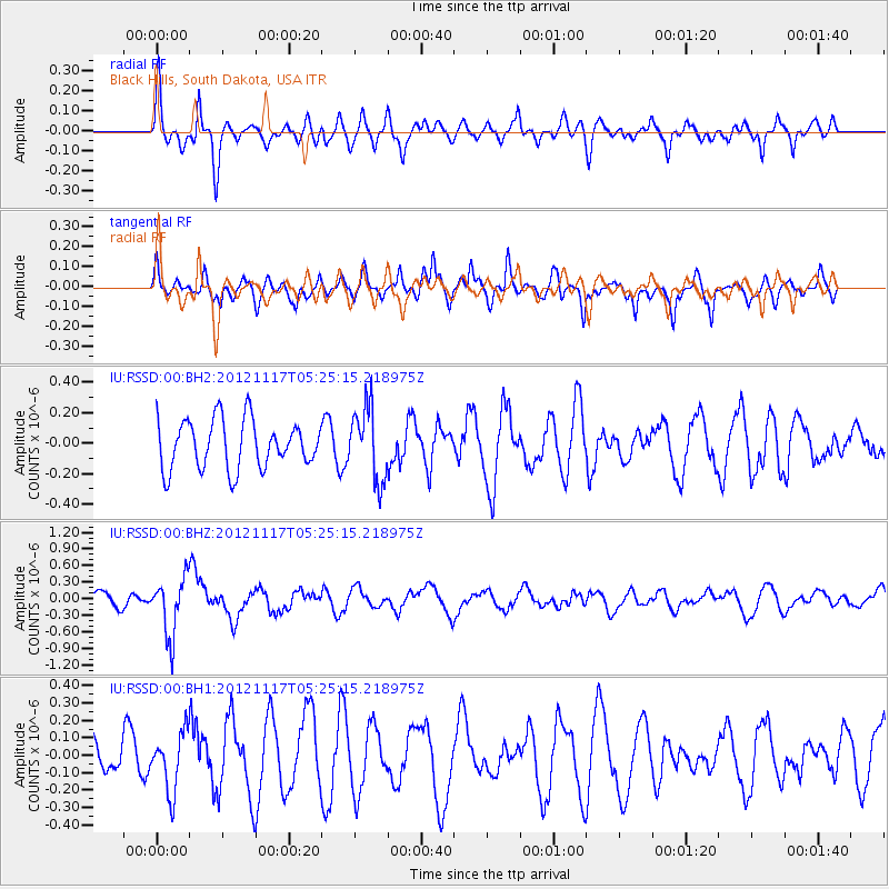
RSSD Black Hills, South Dakota, USA - Earthquake Result Viewer
*The percent match for this event was below the threshold and hence no stack was calculated.
| Earthquake location: |
Tonga Islands Region |
| Earthquake latitude/longitude: |
-18.4/-172.3 |
| Earthquake time(UTC): |
2012/11/17 (322) 05:12:56 GMT |
| Earthquake Depth: |
10 km |
| Earthquake Magnitude: |
5.9 MW, 5.5 MS, 5.8 MB, 5.9 MW |
| Earthquake Catalog/Contributor: |
NEIC PDE/NEIC PDE-W |
|
| Network: |
IU Global Seismograph Network (GSN - IRIS/USGS) |
| Station: |
RSSD Black Hills, South Dakota, USA |
| Lat/Lon: |
44.12 N/104.04 W |
| Elevation: |
2090 m |
|
| Distance: |
88.0 deg |
| Az: |
42.03 deg |
| Baz: |
241.979 deg |
| Ray Param: |
$rayparam |
*The percent match for this event was below the threshold and hence was not used in the summary stack. |
|
| Radial Match: |
65.93343 % |
| Radial Bump: |
389 |
| Transverse Match: |
51.646885 % |
| Transverse Bump: |
400 |
| SOD ConfigId: |
558545 |
| Insert Time: |
2013-09-17 23:57:48.873 +0000 |
| GWidth: |
2.5 |
| Max Bumps: |
400 |
| Tol: |
0.001 |
|
Signal To Noise
| Channel | StoN | STA | LTA |
| IU:RSSD:00:BHZ:20121117T05:25:15.218975Z | 3.0515919 | 5.2544056E-7 | 1.7218574E-7 |
| IU:RSSD:00:BH1:20121117T05:25:15.218975Z | 1.2265086 | 1.677181E-7 | 1.3674432E-7 |
| IU:RSSD:00:BH2:20121117T05:25:15.218975Z | 1.5152445 | 2.404624E-7 | 1.5869547E-7 |
| Arrivals |
| Ps | |
| PpPs | |
| PsPs/PpSs | |


