You are here: Home > Network List > US - United States National Seismic Network Stations List
> Station ELK Elko, Nevada, USA > Earthquake Result Viewer
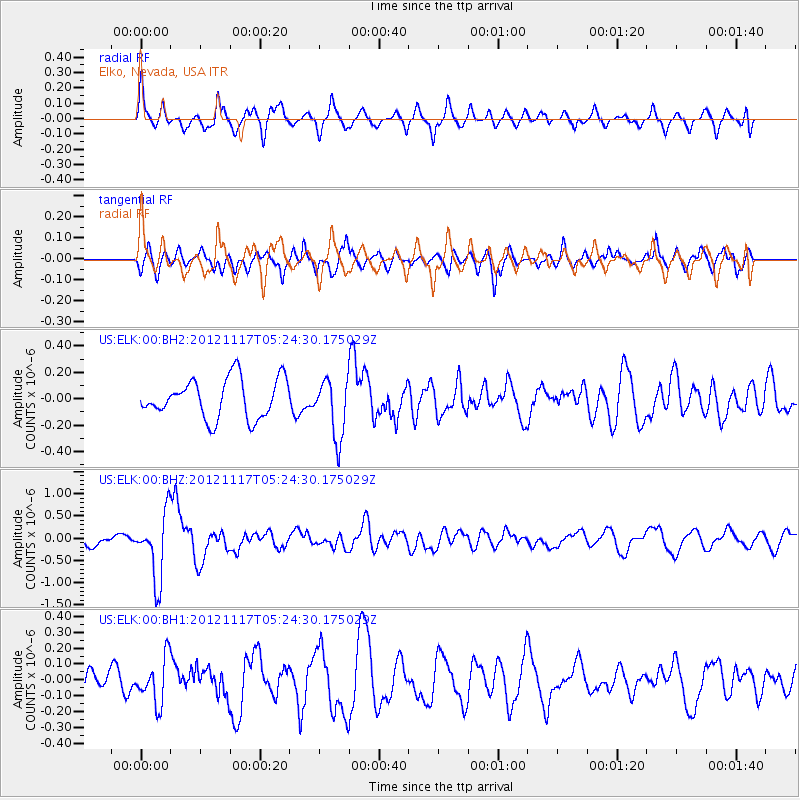
ELK Elko, Nevada, USA - Earthquake Result Viewer
*The percent match for this event was below the threshold and hence no stack was calculated.
| Earthquake location: |
Tonga Islands Region |
| Earthquake latitude/longitude: |
-18.4/-172.3 |
| Earthquake time(UTC): |
2012/11/17 (322) 05:12:56 GMT |
| Earthquake Depth: |
10 km |
| Earthquake Magnitude: |
5.9 MW, 5.5 MS, 5.8 MB, 5.9 MW |
| Earthquake Catalog/Contributor: |
NEIC PDE/NEIC PDE-W |
|
| Network: |
US United States National Seismic Network |
| Station: |
ELK Elko, Nevada, USA |
| Lat/Lon: |
40.74 N/115.24 W |
| Elevation: |
2210 m |
|
| Distance: |
79.1 deg |
| Az: |
40.498 deg |
| Baz: |
234.259 deg |
| Ray Param: |
$rayparam |
*The percent match for this event was below the threshold and hence was not used in the summary stack. |
|
| Radial Match: |
56.839027 % |
| Radial Bump: |
400 |
| Transverse Match: |
70.71589 % |
| Transverse Bump: |
400 |
| SOD ConfigId: |
558545 |
| Insert Time: |
2013-09-17 23:58:52.663 +0000 |
| GWidth: |
2.5 |
| Max Bumps: |
400 |
| Tol: |
0.001 |
|
Signal To Noise
| Channel | StoN | STA | LTA |
| US:ELK:00:BHZ:20121117T05:24:30.175029Z | 4.401773 | 7.501356E-7 | 1.7041668E-7 |
| US:ELK:00:BH1:20121117T05:24:30.175029Z | 1.6393826 | 1.4365685E-7 | 8.762863E-8 |
| US:ELK:00:BH2:20121117T05:24:30.175029Z | 1.5016693 | 2.2397903E-7 | 1.4915337E-7 |
| Arrivals |
| Ps | |
| PpPs | |
| PsPs/PpSs | |


