You are here: Home > Network List > US - United States National Seismic Network Stations List
> Station HLID Hailey, Idaho, USA > Earthquake Result Viewer
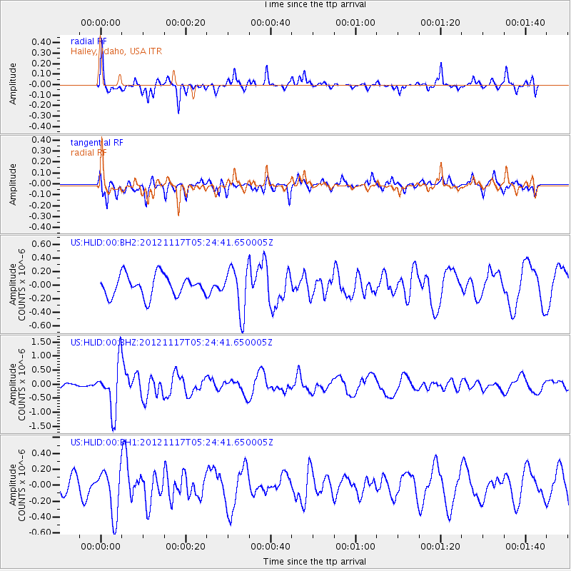
HLID Hailey, Idaho, USA - Earthquake Result Viewer
*The percent match for this event was below the threshold and hence no stack was calculated.
| Earthquake location: |
Tonga Islands Region |
| Earthquake latitude/longitude: |
-18.4/-172.3 |
| Earthquake time(UTC): |
2012/11/17 (322) 05:12:56 GMT |
| Earthquake Depth: |
10 km |
| Earthquake Magnitude: |
5.9 MW, 5.5 MS, 5.8 MB, 5.9 MW |
| Earthquake Catalog/Contributor: |
NEIC PDE/NEIC PDE-W |
|
| Network: |
US United States National Seismic Network |
| Station: |
HLID Hailey, Idaho, USA |
| Lat/Lon: |
43.56 N/114.41 W |
| Elevation: |
1772 m |
|
| Distance: |
81.3 deg |
| Az: |
38.538 deg |
| Baz: |
234.478 deg |
| Ray Param: |
$rayparam |
*The percent match for this event was below the threshold and hence was not used in the summary stack. |
|
| Radial Match: |
63.23231 % |
| Radial Bump: |
307 |
| Transverse Match: |
63.15184 % |
| Transverse Bump: |
400 |
| SOD ConfigId: |
558545 |
| Insert Time: |
2013-09-17 23:59:04.741 +0000 |
| GWidth: |
2.5 |
| Max Bumps: |
400 |
| Tol: |
0.001 |
|
Signal To Noise
| Channel | StoN | STA | LTA |
| US:HLID:00:BHZ:20121117T05:24:41.650005Z | 9.648643 | 8.8295076E-7 | 9.151036E-8 |
| US:HLID:00:BH1:20121117T05:24:41.650005Z | 2.110816 | 2.9616763E-7 | 1.4030954E-7 |
| US:HLID:00:BH2:20121117T05:24:41.650005Z | 2.2322092 | 3.445493E-7 | 1.543535E-7 |
| Arrivals |
| Ps | |
| PpPs | |
| PsPs/PpSs | |


