MBWA Marble Bar, Western Australia - Earthquake Result Viewer
Earthquake location: New Britain Region, P.N.G.
Earthquake latitude/longitude: -5.7/151.6
Earthquake time(UTC): 2012/11/19 (324) 09:44:34 GMT
Earthquake Depth: 13 km
Earthquake Magnitude: 5.9 MB, 5.9 MS, 6.0 MW, 5.9 MW
Earthquake Catalog/Contributor: WHDF/NEIC
Network: IU Global Seismograph Network (GSN - IRIS/USGS)
Station: MBWA Marble Bar, Western Australia
Lat/Lon: 21.16 S/119.73 E
Elevation: 190 m
Distance: 34.5 deg
Az: 240.501 deg
Baz: 68.112 deg
Ray Param: 0.07770845
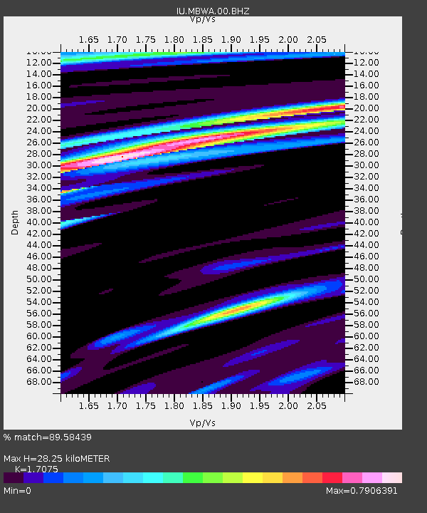
Estimated Moho Depth: 28.25 km
Estimated Crust Vp/Vs: 1.71
Assumed Crust Vp: 6.464 km/s
Estimated Crust Vs: 3.785 km/s
Estimated Crust Poisson's Ratio: 0.24
Radial Match: 89.58439 %
Radial Bump: 325
Transverse Match: 65.59812 %
Transverse Bump: 400
SOD ConfigId: 558545
Insert Time: 2013-09-18 00:02:00.076 +0000
GWidth: 2.5
Max Bumps: 400
Tol: 0.001

Signal To Noise

ChannelStoNSTALTA
IU:MBWA:00:BHZ:20121119T09:50:50.968999Z8.9153542.3002438E-62.5800924E-7
IU:MBWA:00:BH1:20121119T09:50:50.968999Z1.51434054.425685E-72.9225166E-7
IU:MBWA:00:BH2:20121119T09:50:50.968999Z5.45778271.5314386E-62.8059722E-7
Arrivals
Ps3.4 SECOND
PpPs11 SECOND
PsPs/PpSs14 SECOND