You are here: Home > Network List > US - United States National Seismic Network Stations List
> Station DGMT Dagmar, Montana, USA > Earthquake Result Viewer
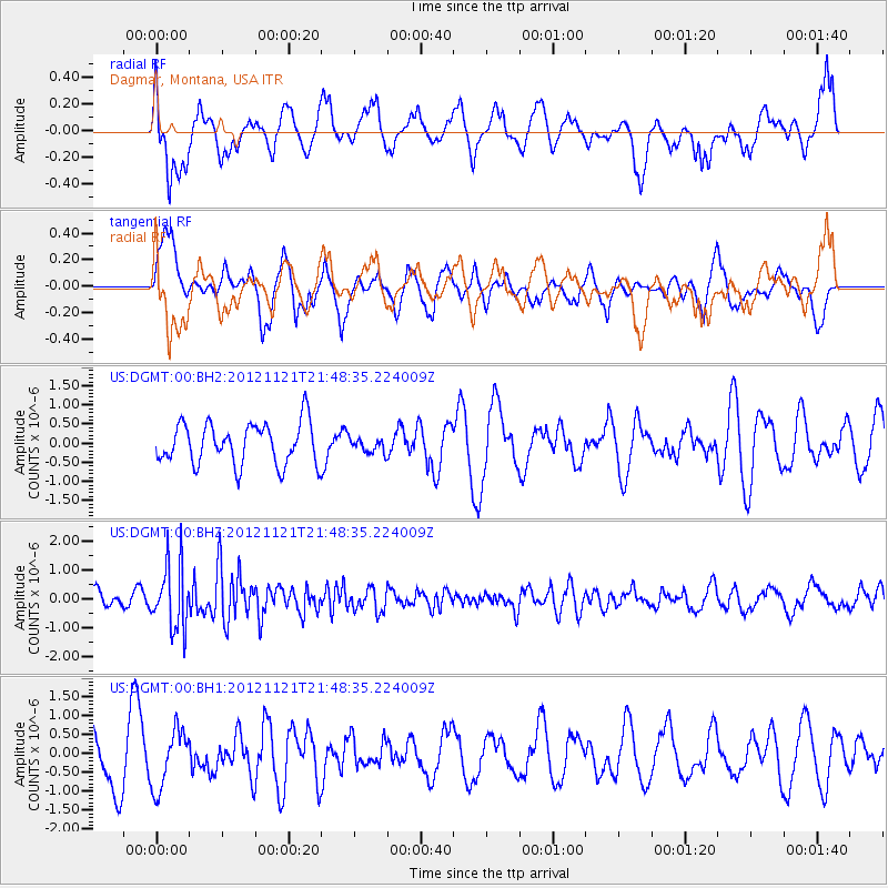
DGMT Dagmar, Montana, USA - Earthquake Result Viewer
*The percent match for this event was below the threshold and hence no stack was calculated.
| Earthquake location: |
Near Coast Of Central Chile |
| Earthquake latitude/longitude: |
-33.9/-71.9 |
| Earthquake time(UTC): |
2012/11/21 (326) 21:36:22 GMT |
| Earthquake Depth: |
18 km |
| Earthquake Magnitude: |
5.7 MB, 5.5 MS, 5.9 MW, 5.8 MW |
| Earthquake Catalog/Contributor: |
WHDF/NEIC |
|
| Network: |
US United States National Seismic Network |
| Station: |
DGMT Dagmar, Montana, USA |
| Lat/Lon: |
48.47 N/104.20 W |
| Elevation: |
0.0 m |
|
| Distance: |
87.0 deg |
| Az: |
339.122 deg |
| Baz: |
153.564 deg |
| Ray Param: |
$rayparam |
*The percent match for this event was below the threshold and hence was not used in the summary stack. |
|
| Radial Match: |
67.67451 % |
| Radial Bump: |
400 |
| Transverse Match: |
40.91236 % |
| Transverse Bump: |
361 |
| SOD ConfigId: |
558545 |
| Insert Time: |
2013-09-18 00:06:50.801 +0000 |
| GWidth: |
2.5 |
| Max Bumps: |
400 |
| Tol: |
0.001 |
|
Signal To Noise
| Channel | StoN | STA | LTA |
| US:DGMT:00:BHZ:20121121T21:48:35.224009Z | 4.0619783 | 1.1079914E-6 | 2.7277133E-7 |
| US:DGMT:00:BH1:20121121T21:48:35.224009Z | 1.1219338 | 7.7103005E-7 | 6.8723307E-7 |
| US:DGMT:00:BH2:20121121T21:48:35.224009Z | 0.34654737 | 1.8694003E-7 | 5.3943575E-7 |
| Arrivals |
| Ps | |
| PpPs | |
| PsPs/PpSs | |


