You are here: Home > Network List > US - United States National Seismic Network Stations List
> Station WMOK Wichita Mountains, Oklahoma, USA > Earthquake Result Viewer
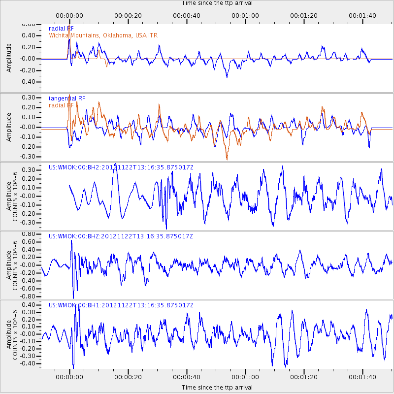
WMOK Wichita Mountains, Oklahoma, USA - Earthquake Result Viewer
*The percent match for this event was below the threshold and hence no stack was calculated.
| Earthquake location: |
Salta Province, Argentina |
| Earthquake latitude/longitude: |
-22.7/-63.6 |
| Earthquake time(UTC): |
2012/11/22 (327) 13:07:10 GMT |
| Earthquake Depth: |
517 km |
| Earthquake Magnitude: |
5.6 MB, 5.9 MW, 6.0 MW |
| Earthquake Catalog/Contributor: |
WHDF/NEIC |
|
| Network: |
US United States National Seismic Network |
| Station: |
WMOK Wichita Mountains, Oklahoma, USA |
| Lat/Lon: |
34.74 N/98.78 W |
| Elevation: |
486 m |
|
| Distance: |
66.2 deg |
| Az: |
328.743 deg |
| Baz: |
144.434 deg |
| Ray Param: |
$rayparam |
*The percent match for this event was below the threshold and hence was not used in the summary stack. |
|
| Radial Match: |
67.15327 % |
| Radial Bump: |
400 |
| Transverse Match: |
66.60179 % |
| Transverse Bump: |
400 |
| SOD ConfigId: |
558545 |
| Insert Time: |
2013-09-18 00:13:04.610 +0000 |
| GWidth: |
2.5 |
| Max Bumps: |
400 |
| Tol: |
0.001 |
|
Signal To Noise
| Channel | StoN | STA | LTA |
| US:WMOK:00:BHZ:20121122T13:16:35.875017Z | 2.0673852 | 3.0860343E-7 | 1.4927235E-7 |
| US:WMOK:00:BH1:20121122T13:16:35.875017Z | 3.0047455 | 2.2668561E-7 | 7.5442536E-8 |
| US:WMOK:00:BH2:20121122T13:16:35.875017Z | 1.2161427 | 1.6749611E-7 | 1.3772734E-7 |
| Arrivals |
| Ps | |
| PpPs | |
| PsPs/PpSs | |


