You are here: Home > Network List > II - Global Seismograph Network (GSN - IRIS/IDA) Stations List
> Station WRAB Tennant Creek, NT, Australia > Earthquake Result Viewer
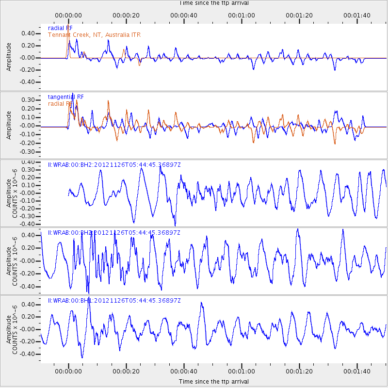
WRAB Tennant Creek, NT, Australia - Earthquake Result Viewer
*The percent match for this event was below the threshold and hence no stack was calculated.
| Earthquake location: |
Southern Xinjiang, China |
| Earthquake latitude/longitude: |
40.4/90.4 |
| Earthquake time(UTC): |
2012/11/26 (331) 05:33:48 GMT |
| Earthquake Depth: |
10 km |
| Earthquake Magnitude: |
5.6 MB, 5.0 MW, 5.1 MW |
| Earthquake Catalog/Contributor: |
WHDF/NEIC |
|
| Network: |
II Global Seismograph Network (GSN - IRIS/IDA) |
| Station: |
WRAB Tennant Creek, NT, Australia |
| Lat/Lon: |
19.93 S/134.36 E |
| Elevation: |
366 m |
|
| Distance: |
72.7 deg |
| Az: |
136.789 deg |
| Baz: |
326.242 deg |
| Ray Param: |
$rayparam |
*The percent match for this event was below the threshold and hence was not used in the summary stack. |
|
| Radial Match: |
69.35509 % |
| Radial Bump: |
400 |
| Transverse Match: |
71.78693 % |
| Transverse Bump: |
400 |
| SOD ConfigId: |
558545 |
| Insert Time: |
2013-09-18 00:18:07.396 +0000 |
| GWidth: |
2.5 |
| Max Bumps: |
400 |
| Tol: |
0.001 |
|
Signal To Noise
| Channel | StoN | STA | LTA |
| II:WRAB:00:BHZ:20121126T05:44:45.36897Z | 1.1245478 | 2.366707E-7 | 2.1045854E-7 |
| II:WRAB:00:BH1:20121126T05:44:45.36897Z | 2.0014405 | 2.405269E-7 | 1.2017689E-7 |
| II:WRAB:00:BH2:20121126T05:44:45.36897Z | 1.6313739 | 2.1435434E-7 | 1.3139498E-7 |
| Arrivals |
| Ps | |
| PpPs | |
| PsPs/PpSs | |


