You are here: Home > Network List > US - United States National Seismic Network Stations List
> Station EGMT Eagleton, Montana, USA > Earthquake Result Viewer
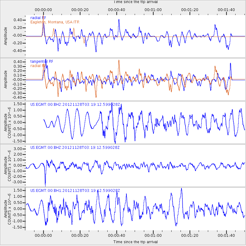
EGMT Eagleton, Montana, USA - Earthquake Result Viewer
*The percent match for this event was below the threshold and hence no stack was calculated.
| Earthquake location: |
Northern Peru |
| Earthquake latitude/longitude: |
-4.5/-76.1 |
| Earthquake time(UTC): |
2012/11/28 (333) 03:09:48 GMT |
| Earthquake Depth: |
118 km |
| Earthquake Magnitude: |
5.9 MB, 5.6 MW, 5.7 MW |
| Earthquake Catalog/Contributor: |
WHDF/NEIC |
|
| Network: |
US United States National Seismic Network |
| Station: |
EGMT Eagleton, Montana, USA |
| Lat/Lon: |
48.02 N/109.75 W |
| Elevation: |
1055 m |
|
| Distance: |
60.1 deg |
| Az: |
334.578 deg |
| Baz: |
140.393 deg |
| Ray Param: |
$rayparam |
*The percent match for this event was below the threshold and hence was not used in the summary stack. |
|
| Radial Match: |
61.673645 % |
| Radial Bump: |
400 |
| Transverse Match: |
67.30545 % |
| Transverse Bump: |
400 |
| SOD ConfigId: |
558545 |
| Insert Time: |
2013-09-18 00:24:04.649 +0000 |
| GWidth: |
2.5 |
| Max Bumps: |
400 |
| Tol: |
0.001 |
|
Signal To Noise
| Channel | StoN | STA | LTA |
| US:EGMT:00:BHZ:20121128T03:19:12.599028Z | 3.4991972 | 9.967216E-7 | 2.848429E-7 |
| US:EGMT:00:BH1:20121128T03:19:12.599028Z | 1.9634808 | 7.414304E-7 | 3.776102E-7 |
| US:EGMT:00:BH2:20121128T03:19:12.599028Z | 0.96295184 | 6.0104736E-7 | 6.241718E-7 |
| Arrivals |
| Ps | |
| PpPs | |
| PsPs/PpSs | |


