You are here: Home > Network List > US - United States National Seismic Network Stations List
> Station HAWA Hanford, Washington, USA > Earthquake Result Viewer
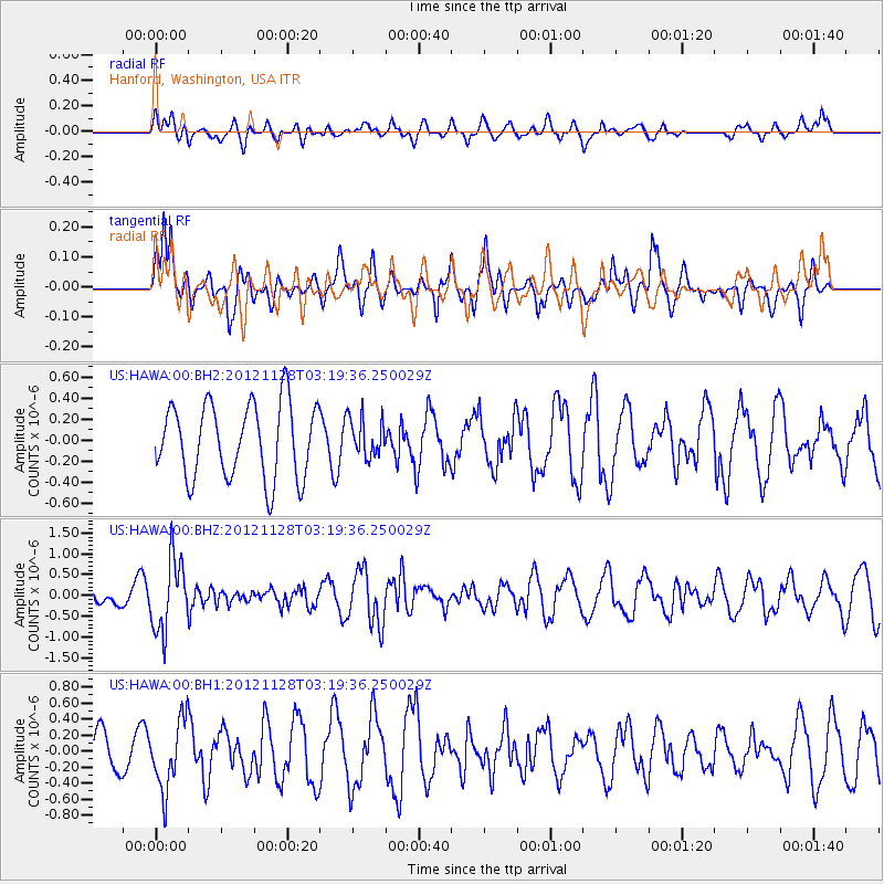
HAWA Hanford, Washington, USA - Earthquake Result Viewer
*The percent match for this event was below the threshold and hence no stack was calculated.
| Earthquake location: |
Northern Peru |
| Earthquake latitude/longitude: |
-4.5/-76.1 |
| Earthquake time(UTC): |
2012/11/28 (333) 03:09:48 GMT |
| Earthquake Depth: |
118 km |
| Earthquake Magnitude: |
5.9 MB, 5.6 MW, 5.7 MW |
| Earthquake Catalog/Contributor: |
WHDF/NEIC |
|
| Network: |
US United States National Seismic Network |
| Station: |
HAWA Hanford, Washington, USA |
| Lat/Lon: |
46.39 N/119.53 W |
| Elevation: |
364 m |
|
| Distance: |
63.6 deg |
| Az: |
327.912 deg |
| Baz: |
130.08 deg |
| Ray Param: |
$rayparam |
*The percent match for this event was below the threshold and hence was not used in the summary stack. |
|
| Radial Match: |
38.46301 % |
| Radial Bump: |
400 |
| Transverse Match: |
82.11806 % |
| Transverse Bump: |
400 |
| SOD ConfigId: |
558545 |
| Insert Time: |
2013-09-18 00:24:19.482 +0000 |
| GWidth: |
2.5 |
| Max Bumps: |
400 |
| Tol: |
0.001 |
|
Signal To Noise
| Channel | StoN | STA | LTA |
| US:HAWA:00:BHZ:20121128T03:19:36.250029Z | 1.9723434 | 8.6147145E-7 | 4.367756E-7 |
| US:HAWA:00:BH1:20121128T03:19:36.250029Z | 1.3958298 | 4.2985437E-7 | 3.0795616E-7 |
| US:HAWA:00:BH2:20121128T03:19:36.250029Z | 0.5272922 | 1.8669483E-7 | 3.5406333E-7 |
| Arrivals |
| Ps | |
| PpPs | |
| PsPs/PpSs | |


